 |
|
|
MIAMI RIVER COMMISSION| JAMES MURLEY, CHAIR
Urban Infill Minutes 2011 |
- January 14, 2011
- February 15,2011
- March 17, 2011
- April 14, 2011
- May 17, 2011
- June 27, 2011
- November 22, 2011
I. Plans
A. Potential to Increase Public Access to Marlins Stadium via Miami River - UIWG Chair Jim Murley welcomed Mr. Jose Gonzalez, City of Miami, Office of the City Manager/Transportation, and explained the American Institute of Architects’ (AIA) 2010 “Miami River Corridor Catalyst Project” had addressed key issues along the Miami River and had envisioned the Marlins Stadium as a great opportunity. UIWG Chair Murley stated he shared in the AIA’s vision of identifying ways to utilize the Miami River as a transportation corridor.
Mr. Gonzalez stated the City of Miami, Miami-Dade County and the Marlins recognize the importance of providing transportation to and from the stadium. Mr. Gonzalez noted the Marlin’s Major Use Special Permit (MUSP) had been approved by the city with a condition that they develop a holistic, multimodal transportation plan. Building on the realization that transportation is a crucial element for the success of the stadium, the Miami-Dade County Office of Sustainability, the City of Miami and Marlins representatives created a Task Force to create the aforementioned transportation plan. Mr. Gonzalez noted he and fellow City of Miami representative Robert Fenton serve on the Task Force and are essentially the program managers for the parking garages at the stadium (overseeing its development and construction). Mr. Gonzalez stated the Task Force, which has been meeting for over a year, is chaired by Ms. Kathy Sweetapple. Mr. Gonzalez explained the goal of the Task Force is to develop the transportation plan and get it ready for implementation. Mr. Gonzalez noted the Transportation plan will consist of many elements, including but not limited to: transit and street dynamics, waterborne transportation, bicycle and pedestrian components, and traffic control. Mr. Gonzalez noted he is primarily tasked with bicycle and pedestrian transit. Mr. Gonzalez added Miami-Dade County is well represented on the Task Force, with individuals from Public Works, Transit, and the Office of Sustainability. Mr. Gonzalez stated Mr. Ray Baker and Susy Torriente are the County’s lead representatives.
Mr. Gonzalez provided an overview of initiatives the Task Force is currently considering:
- A shuttle bus plan has already been developed to shuttle patrons from the Culmer Station to the Marlins stadium (an 8-minute ride each way); Mr. Gonzalez noted a bus would be on hand every 5 minutes (pre and post-game) to shuttle people back and forth. The route is South on NW 7 Ave, over the Miami River’s 5 ST Bridge, West on NW 2 ST, North on NW 16 Ave, stopping on NW 16 Ave & NW 4 ST. An alternate shuttle bus return route from the Stadium to the Culmer Metro-Rail station is North along NW 16 Ave, West on NW6 ST, North on NW 17 Ave, over the Miami River’s 17 Ave Bridge, East on North River Drive, east on NW 11 ST.
- Task Force Chair Kathy Sweetapple has petitioned the U.S. Coast Guard to further restrict Miami River bridge openings pre and post-game
- City of Miami Trolley/Health Center Loop-Mr. Gonzalez stated the city is considering extending the Health Center trolley (bus looks like a trolley car) transportation “loop” over the Miami River’s 12th Avenue Bridge, as well as increasing its working hours to 12, in order to serve the stadium; Mr. Gonzalez noted the city is in the process of issuing a Request for Proposals (RFP) to obtain a trolley operator; Mr. Gonzalez added City of Miami District Commissioner Frank Carollo supports the vision for the Marlins stadium and is very supportive of the trolley project
- A meeting has been conducted between the Marlins and a company called Waterborne Transportation Alternatives (which operates out of Fort Lauderdale and Miami Beach) to discuss providing waterborne transportation to and from the stadium; Mr. Gonzalez stated the Marlins have essentially taken the lead on the plan’s waterborne transportation initiatives, but continue to update him on their progress
- Waterborne Transportation Ideas-1) patrons can park their cars at the Justice Building, County GSA, etc. and a company can take them across the river via a barge; once the barge is docked across the river, patrons can walk to the stadium across NW 7th Street. Mr. Gonzalez noted Mr. Baker is currently developing this idea as well as coordinating parking issues; 2) Provide a water ferry service along the Miami River to and from the stadium. Patrons can park their cars in the Downtown area and take the ferry; Task Force still needs to determine the number and frequency of water ferry stops; Mr. Gonzalez noted Waterborne Transportation Alternatives had been approached about both potential opportunities
- Mr. Gonzalez noted he had mentioned incorporating Miami-Dade County’s Robert King High Elderly Housing Development at 1407 NW 7 Street (directly across the street from the stadium) into the plan, specifically via the construction of a publicly accessible riverwalk; Mr. Gonzalez noted he had mentioned creating a pedestrian path through Robert King High to provide public access between the water bus dock and stadium
- In terms of pedestrian safety, Mr. Gonzalez noted police will have to play an important role in limiting and managing street crossings to and from the stadium
Questions/Comments:
- UIWG Chair Murley suggested inviting the Stadium Transportation Task Force representatives to the next UIWG meeting or perhaps allow Mr. Bibeau and himself to attend the next Stadium Transportation Task Force meeting
- Mr. Bibeau explained the Miami River is a federal navigable channel in which boats predominantly have the right of way. Mr. Bibeau stated over a decade ago the U.S. Coast Guard and Federal Register established a series of Miami River Bridge “lockdown” times in order to accommodate the temporary delay bridge openings create for cars. The original lockdown times were from 7:30 - 9 am and 4:30-6 pm. Mr. Bibeau noted several years ago additional Miami River Bridge lockdowns were established between noon and 1 pm. Mr. Bibeau added that in between these three lock down times (Monday-Friday), the Brickell Bridge only opens on the hour and half-hour. For safety reasons Bridges open on demand for vessels under tow.
- UIWG Chair Murley stated the Task Force needs to evaluate ADA compliance, safety and security, and offered his assistance. Mr. Gonzalez stated the plan does address and provide security. Mr. Gonzalez mentioned that bicycle parking-with security-will be provided on the first level of the stadium’s parking garage
- Mr. Bibeau noted it is important to develop the best, most appropriate pedestrian route to and from the stadium so as to not disrupt the privacy of adjacent residential homeowners. Mr. Bibeau noted some GOB funding is available to potentially construct a publicly accessible riverwalk at Robert King High.
- UIWG Chair Murley suggested the Task Force look into creating a first-class dock or disembarkment for the water ferry to avoid potential safety or liability issues; In addition, directional signage to and from the stadium should be provided along a safe, clear and well-lit pedestrian path.
- Mr. Bibeau explained that several of the Miami River Greenway sections, directly connecting downtown to the baseball stadium, are fully funded and designed, yet the Florida Department of Transportation (FDOT) usually takes 6 months to approve the construction engineering documents. Therefore, Mr. Bibeau suggested the City encourage FDOT to expedite their review and approval of the Miami River Greenway plans in order to try and have the sections constructed before upon completion of the stadium.
- Mr. Bibeau asked when the stadium is expected to open, and Mr. Gonzalez replied by April 2012. Mr. Bibeau stated if FDOT takes the full 6 months to approve the design, then construction of the Miami River Greenway along South River Drive / NW 7 ST from 10th to 12th Avenue would be finished on November 20, 2012, 8 months after the baseball stadium opens. Upon completion, the Miami River Greenway will provide pedestrians and bicyclists a safe route to the baseball stadium, which is located across the street (NW 7 ST) from the Miami River’s south shore.
- UIWG Chair Murley asked for the Stadium Transportation Task Force Draft Plan to be presented to the UIWG and MRC
Mr. Bibeau distributed page 113 of the Miami River Corridor Multi-modal Transportation Plan pertaining to “Traffic flow modifications on NW 17th Avenue at South River Drive/S.R. 836 Eastbound exit ramp (R21,22).” Mr. Bibeau explained that currently, the three northbound lanes on NW 17th Avenue unnecessarily bottleneck / merge into only one lane while passing beneath SR 836, but the pavement is actually wide enough to create two northbound lanes to continue north over the adjacent NW 17 Ave Bridge, which has 2 northbound lanes. Mr. Bibeau noted traffic congestion would be improved by restriping the pavement/asphalt to create two straight northbound lanes. Mr. Gonzalez stated he would forward this suggestion to the appropriate person.
Mr. Bibeau distributed page 106 of the Miami River Corridor Multi-Modal Transportation Plan, pertaining to the installation of Intelligent Transportation Systems (ITS) signage adjacent to Miami River Bridges to improve traffic flow. Mr. Bibeau explained the ITS/message signs can provide drivers with useful information regarding bridge openings, the direction of vessels and alternative travel routes. Mr. Gonzalez stated he would forward this information as well.
UIWG Chair Murley thanked Mr. Gonzalez for his report and noted he would provide a brief update to the MRC regarding this agenda item at its next publicly noticed meeting on Monday, February 7, 2011, noon, Robert King High Board Room, 1407 NW 7 Street.
B. Update of Miami Intermodal Center, Grand Central Station and Palmer Lake -Ms. Helen Brown, Miami-Dade County Department of Planning & Zoning, stated the draft Palmer Lake Report is expected to be completed by the end of January. Mr. Bibeau stated a date has yet to be set for the Palmer Lake Steering Committee to review the draft plan, but would keep the UIWG updated.
C. Status of Comprehensive Planning in the City of Miami and Miami-Dade County
- Update of Ongoing Evaluation Appraisal Report (EAR) Process-Ms. Brown stated the County’s draft EAR is scheduled to be considered by the Board of County Commissioners in late March. UIWG Chair Murley noted Miami-Dade County had recently created a “Green Plan,” and asked Ms. Brown if it could be presented to the UIWG in February. Ms. Brown stated she would try to accommodate this request.
- Miami River Corridor Urban Infill Plan - Mr. Bibeau provided an email seeking an electronic and amendable version of the Plan from the MRC hired consultants, Kimley Horn and Associates.
New Business: Mr. Bibeau noted the Miami-Dade County Office of Grants Coordination had recently applied to an Environmental Protection Agency (EPA) grant to help replace older vessel engines with new engines which use significantly less fuel and generate less carbon emissions. Mr. Bibeau noted as requested by County staff, MRC staff had helped the County obtain over 20 marine vessel engine repower/replacement surveys from commercial fishermen and tug boat operators along the Miami River who could potentially benefit from this opportunity-if the county is awarded the grant funding. The County applied for the maximum $2 million. If awarded the County would conduct a competitive process to determine how to fairly distribute the funding to vessel owners, whom would be required to provide a 25% funding match.
The UIWG confirmed its next publicly noticed meeting for Tuesday, February 15, 2011, 10 AM. The meeting adjourned.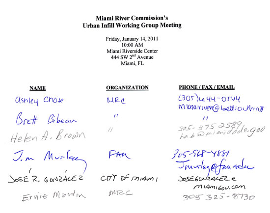
|
January 14, 2011| THIS IS A PUBLIC DOCUMENT
The Miami River Commission’s (MRC) Urban Infill Working Group (UIWG) convened a public meeting on January 14, 2011, 10 AM, at the Miami Riverside Center, 444 SW 2nd Avenue. The UIWG accepted the December 9, 2010 UIWG meeting minutes. UIWG Chairman Jim Murley chaired the meeting and attendees provided self-introductions. The attendance sheet is enclosed |
I. Projects
B. Update of Miami-Dade Transit’s Metrorail Airport Link and M-Path Project -UIWG Chairman Murley welcomed Ms. Rosalyn Contreras, Public Information Officer for MDT-CEI Airport Link, whom presented a brief PowerPoint presentation of the project and distributed a “Miami-Dade Transit’s (MDT) Airport Link Metrorail Extension” Fact Sheet. (Ms. Contreras noted she would provide MRC staff with a copy of her presentation as well as additional information such as proposed road closures, construction timelines and potential community impacts). The distributed Fact Sheet and PowerPoint contained the following information:
- “The MDT Airport Metrorail Extension Project is a 2.4-mile-long elevated Metrorail extension from the existing Earlington Heights Station to the new Miami Intermodal Center (MIC) Station
- Construction began in Spring of 2009 and should be completed by Spring of 2012
- Features a multilevel Miami International Airport (MIA) Station which will provide passengers with a central transfer point to different modes of transportation, including Metrorail, Metrobus, Tri-Rail, and an automated People Mover that connects to MIA
- Project boundaries: The Airport Link will branch from the existing Earlington Heights Station westbound over NW 27th Avenue, parallels to SR-112 and begins a southward path just west of NW 37th Avenue. The alignment crosses the Miami River just east of the South Florida Rail Corridor Bridge, continuing southbound and terminating at the MIC, with the multilevel MIA Station east of the MIC’s Rental Car Facility”
Ms. Contreras deferred to Mr. Manuel Garcia, MDT-CEI, to provide details on road closures. Ms. Contreras and Mr Garcia stated they would provide the detailed road closure plans, areas, schedules, etc in writing to the MRC, and they would be widely noticed and distributed throughout the community, area, etc.
Mr. Rick Eyerdam, Miami River Marine Group, asked if these closures would have any impact on motorists and traffic signalization, and Mr. Garcia replied no, as all details have been coordinated with FPL, CSX, MDC-Public Works, etc.
Mr. Eyerdam asked if the project would impact vessel traffic along the Miami River, and Project Manager Jorge Mendoza, ODTC JV, replied a Miami River Crossing Plan has been developed which will utilize a system of barges and lifting cranes to erect the crossing (7 am to 6 pm) without impacting river traffic.
UIWG Chair Murley asked for the status of the seawall that had fallen into the river (in the form of big concrete slabs) from the property in which the county imminent domains on the Miami River. Mr. Surinder Sahota, Miami-Dade Transit, stated he had met with MRC Managing Director Brett Bibeau and had informed him that the county planned to finish the construction of the project firstly before focusing its attention on this bulkhead. Mr. Sahota added the county had estimated the potential cost of repairing the bulkhead at $1 million and was currently looking into different options to pay for this work i.e. having someone pay for the seawall replacement in exchange for leasing this county site.
Mr. Bibeau referenced the UIWG’s April 20, 2010 meeting minutes in which the repair/restructuring of the bulkhead was publicly addressed: “Mr. Bibeau stated Mr. Carmichael, VIP Chair, and he recently met with Miami-Dade Transit (MDT) and asked if-as a part of their $500 million MetroRail expansion project-they intended to remove the concrete slabs which had fallen into the dredged Miami River, and then construct a new seawall. Mr. Bibeau noted MDT had indicated the removal of the concrete slabs was not in their current scope of services, nor did they have the money to perform a change-order to their scope of services in order to remove them and build a new seawall. Mr. Bibeau explained that as construction continues of the new/additional MetroRail Bridge, MDT runs the risk of having more of their broken seawall fall into the recently dredged Miami River. Mr. Bibeau reported he and VIP Chair Jay Carmichael had a very positive meeting with MDT last week, in which MDT had expressed a willingness to include the removal of the concrete slabs as a part of their scope of services, if they are able to identify money to perform this task.”
Mr. Bibeau asked how it would be possible to dock a barge along this bulkhead and have a large heavy crane erected to lift large heavy concrete pieces of bridge off of the barge due to the concrete slabs currently in the river, and hallowed out shoreline. Mr. Mendoza replied the barge will not be secured to the seawall. Mr. Eyerdam noted that the “undermine” would also need to be addressed. Mr Mendoza assured attendees that they would fully inspect the area before commencing this planned operation / installation in the near future and ensured it will be done safely.
Mr. Bibeau stated he had suggested at the April 2010 UIWG meeting that the county apply to Florida Inland Navigation District (FIND) grant funding and/or using money from the existing Miami-Dade County Department of Environmental Resources Management (DERM) in order to help stabilize the shoreline and repair the seawall. Mr. Bibeau noted that FIND applications are due by April 2011, and require a 50% match. Mr. Bibeau offered his assistance to author the FIND grant application, and Mr. Sahota noted he would check on the match as well as look into additional options.
Mr. Mike Hatami, Mirage Yachts, asked for the timeframe for the proposed barge as he would need to coordinate the relocation of a 50-foot-tall ship currently at his property. Mr. Mendoza and the construction team noted the construction of Pier 28 is expected to be completed by the end of May, while Pier 29 (the cantilevered portion) is expected to be completed by April. The construction team therefore recommended that Mr. Hatami relocate his vessel before March 19 and encouraged him to coordinate these efforts with Ms. Contreras.
Mr. Bibeau asked for an update regarding improving the “M Path” (Pedestrian Walkway) to connect Miami-Dade Public Works’ planned riverwalk beneath Metro Rail’s North Shore to the adjacent Southwest Third Street. At the April 2010 UIWG meeting, Mr. Bibeau had noted “the planned riverwalk on the south side is only 25 feet from the river to the upland site, and the existing M-Path proceeds one block to SW 7th Street before connecting perfectly to the riverwalk. Mr. Bibeau noted however, that the same cannot be said for the north side, as the riverwalk does not connect to what’s left of the M-Path. Mr. Bibeau stated he has therefore requested that additional improvements/repairs be made to the M-Path so that the riverwalk can connect to the adjacent SW 3rd Street. Mr. Bibeau stated that when presented with this concept, MDT had indicated they did not have the money to perform these improvements.” Mr. Bibeau stated he had recently performed a site visit with MDT whom agreed to try and use the leftover funding from the M-Path improvement project to include this additional block. Mr. Bibeau stated he had reminded MDC MDT and PW that the property owner, Keyes International, had proffered two small donations of their land-free of charge- to the county so that the planned public riverwalk connection could be established, which still needs to be formally accepted by the County. Mr. Sahota stated he did not have an update at this time as the County is reviewing drawings to confirm the former river path (the existing fence is encroaching on MDT property), but noted he would have more to report by next week. Greenways Subcommittee Chair Dr. Ernie Martin asked to place future updates of this item on future GSC meeting agendas.
UIWG Chair Murley thanked MDT and the construction team for their presentation.
A. Presentation of New “Big Fish” Proposed Plans, 55 SW Miami Avenue Road - UIWG Chair Murley welcomed Mr. Ben Fernandez, Bercow, Radell & Fernandez, and project architect D.B. Lewis, DB Lewis Architecture & Design, whom presented a revised proposal for the former site of Big Fish restaurant, 55 SW Miami Avenue Road, west of the South Miami Avenue Bridge on the south bank of the Miami River. Mr. Lewis noted the former plans, presented to the UIWG in May 2010, had included a hotel component, which has been removed. Mr. Lewis presented “preliminary plans” and provided the following project details:
- “Big Fish” name will be maintained
- Contemporary two-story restaurant structure evoking nautical imagery
- Will have a separate café/lounge (open-air dining experience)
- Courtyard and monument trees to be preserved
- The site of the former Big Fish has been cleared and ready to move forward on infrastructure
- Public riverwalk included in plans
- will maintain promenade setbacks
- rebuilding seawall (currently in permitting); construction of the seawall will commence first
- would like to keep 4 current boat slips active
Questions/Comments
- UIWG Chair Murley asked if this is considered a new project, and Mr. Fernandez replied it is a modification of their formerly submitted permit application and will therefore be abiding by the guidelines of the City of Miami’s Zoning Code 11000-and not the newly adopted Zoning code Miami 21; Mr. Tony Perez, City of Miami Planning Department, confirmed the project has an active Class II Special Permit Application and is requesting a modification
- GSC Chair Martin asked if the proposed project will come before the City of Miami Planning & Zoning Appeals Board (of which he serves) for review, and Mr. Perez replied yes. Mr. Fernandez added the proposed project will also come before the Miami City Commission as they will be requesting a front and sideyard setback variances. As the project is a potential voting item at the Planning & Zoning Appeals Board, GSC Chair Martin stated he would therefore reserve his comments strictly to the public Miami River Greenway. Similar to the previous public MRC UIWG meeting, Mr Fernandez. Dr Martin concurred there was no conflict.
- Mr. Lewis explained since the property is less than 50-feet-wide, the waterfront building setback becomes 25% of the property width from sidewalk to shoreline, and is therefore requesting a variance.
- Ms. Helen Brown, Miami-Dade County Planning & Zoning, asked how many parking spaces would be provided, and Mr. Lewis replied they anticipate providing 20 (based on a count of adjacent on-street metered parking and vacant lots, as no on-site parking will be provided); Mr. Lewis explained the 200-seat restaurant requires at least 800 square feet of parking, which will be met; UIWG Chair Murley asked if the city will ensure that the parking requirement is met, and Mr. Perez replied yes
- Mr. Fernandez stated the developer wishes to maximize on the efficiency of the waterfront and will therefore be applying for a charter waiver of the front and sideyard setback requirements
- Mr. Bibeau asked if any of the proposed structure is located on Florida Department of Transportation (FDOT) property, since he recalled there was a parcel located in between the bridge and the former proposed project, and Mr. Fernandez replied no. Mr. Fernandez explained the wall to the property line is only 9 inches wide, according to the surveyor, and therefore no land would need to be requested from FDOT
- Mr. Fernandez noted considering the less than 200’ deep parcel, they are providing the full required width of the riverwalk (13 feet) in exchange for pushing up the front of the building to the street property line (requesting a front variance- for 0’ setback)
- The UIWG Chair Murley discussed the possibility of removing the tall concrete wall along the length of the site, which runs directly along the City’s 100% designed and federal grant funded on-road Greenway on the street in front of the site. Mr. Lewis explained it was meant to keep out dirt, dust and wind, but would consider revising the plans to make the gate portals wider, and would consider removing the wall and more transparent to maximize riverfront views
- Mr. Bibeau asked for more details regarding what is expected to be requested by the Miami City Commission, and Mr. Fernandez clarified that they will be requesting a parking waiver, frontyard and sideyard variances
Mr. Bibeau cited the May 6, 2010 MRC meeting minutes in which the board moved a resolution to find the proposed project at 55 SW Miami Avenue Road consistent with the Miami River Greenway Action Plan and the Miami River Corridor Urban Infill Plan, subject to the following three conditions:
“1. Include a 5-foot-wide cantilevered boardwalk to expand width of publicly accessible riverwalk to 18 feet wide, and increase depth for public temporary vessel dockage
2. Include a minimum 5-foot wide connector on both side yards to connect the sidewalk to the public riverwalk and increase functionality of the Greenway system, consistent with the waterfront and setback provisions set forth in the Miami City Charter, City of Miami Neighborhood Comprehensive Plan, and the Miami River Greenway Design Standards and Guidelines
3. Incorporate more detail/develop a design solution for the center courtyard in order to help public understand that it is indeed open to the public and make it as inviting as possible”
Condition 1: Mr. Fernandez noted the surveyor indicated that FDEP was not willing to lease the submerged land to create the 5-foot-wide cantilevered boardwalk as they were unable to demonstrate a hardship. Mr. Bibeau noted FDEP executed similar submerged land leases for the same type of 5-foot wide cantilevered public riverwalks in Lummus Park and Epic, because the applicants demonstrated the public riverwalk as a viable public use, and agreed to assist Mr. Fernandez in this effort.
Condition 2: the minimum 5 feet wide sideyards with public riverwalk connectors are being included; therefore, this condition has been met.
Condition 3: Mr. Lewis stated he would respond to this condition by developing a solution to maximize views and increase public accessibility.
UIWG Chair Murley thanked Mr. Fernandez and Mr. Lewis for their presentation and suggested that they come back to the UIWG when “ready.”
II. Plans
C. Update of Miami-Dade County Palmer Lake Charrette - The County’s draft report is not yet ready for review and distribution by the County.
D. Presentation of Miami-Dade County “Green Print” Plan -UIWG Chair Murley welcomed Ms. Maggie Fernandez, Miami-Dade County Office of Sustainability, whom presented an overview of the “Green Print Plan,” a plan developed by Miami-Dade County to implement environmental, sustainable initiatives:
- Ms. Fernandez serves as the Assistant Director, and manages community outreach and the energy efficiency block grant program
- Sustainability, environmental and climate change have become priorities for the Board of County Commissioners; over 110 initiatives focusing on these efforts have been implemented since 1990
- Agreed to reduce emissions by 80% by 2050
- As Miami-Dade County is vulnerable to climate change and sea level rise, the “Green Print Plan” was developed to address these issues and improve quality of life and protect the environment
- Plan was developed with existing resources and with help from the Mayor’s Sustainability Advisory Board and Climate Change Task Force in response to Miami-Dade County Board of County Commissioners’ legislation/mandates; Office of Sustainability was asked to develop a sustainability plan in Spring 2009; an advisory board was subsequently created to review all existing plans (looked at over 360 initiatives); The “Green Print Plan” was presented to the BCC on March 1, 2010 (it was not codified or adopted as an ordinance; it was simply accepted)
- The “Green Print Plan” developed a five-year action plan; annual reports to be provided
- It’s essentially a “community plan;” seeking partnerships, strong leadership and connections to help implement over 137 initiatives, which are divided by goal area (7 total goal areas)
- The first goal area is the sustainability and climate action plan (milestone 1)
- Hope to increase public transportation ridership and reduce carbon emissions by 8400 metric tons of CO2E (Carbon Dioxide equivalent), as well as reduce greenhouse gas emissions by 1.5 million metric tons
- Plan is available online at green.miamidade.gov
UIWG Chair Murley offered his assistance as a pilot for this initiative. Ms. Fernandez thanked him for his support and noted the county would like to create a new group or team to make sure that the plan’s goals are implemented. Ms. Fernandez suggested the MRC review the “Green Print Plan’s” initiatives to determine which goals they would like to be a part of, and she would then include the MRC as a partner. UIWG Chair Murley thanked Ms. Fernandez for her presentation and noted he would mention the “Green Print Plan” to the MRC as part of his UIWG subcommittee report at the Monday, March 7 board meeting.
III. New Business
- Mr. Bibeau distributed page 34 of the American Institute of Architects (AIA) “Miami River Catalyst Plan,” which addresses Transportation and Connectivity with a map depicting using parking lots on north side of the river and then waterbuses to cross the river to access the baseball stadium. “Transportation Hierarchy Principle: a hierarchy of transportation modes is an important method of organizing and prioritizing movement throughout the region whether referring to active transportation (bicycle and pedestrian), transit (air, commuter rail, Metrorail, light-rail, modern streetcar, bus, taxi, van), freight (ship, rail, truck, delivery van), private autos and boats.”
- UIWG Chair Murley stated he and Director Bibeau were invited and attended a meeting with the County and City regarding multi-modes of transportation in the Health District and Ballpark areas, including but not limited to Waterbus and Riverwalk, both of which the MRC has recommended for years.
- Mr. Bibeau noted the Miami-Dade County Board of Commissioners approved an agreement between Miami-Dade County and the Miami Parking Authority (MPA) in September 2010 to construct the drainage at Site 6 (Miami-Dade County Water & Sewer Department vacant lot along NW North River Drive), which will commence on March 2. Mr. Bibeau noted the design was completed (for the parking lot) and a permit submitted. Mr. Bibeau added this is expected to be followed by the Miami Parking Authority striping the parking lot, installing parking meters and removing the fence.
The meeting adjourned.
|
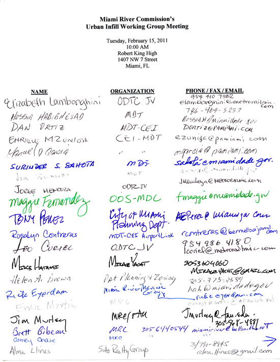
February 15, 2011 | THIS IS A PUBLIC DOCUMENT
The Miami River Commission’s (MRC) Urban Infill Working Group (UIWG) convened a public meeting on February 15, 2011, 10 AM, at the Robert King High Board Room, 1407 NW 7 Street. UIWG Chairman Jim Murley chaired the meeting and attendees provided self-introductions. The attendance sheet is enclosed.
|
I. Projects
A. Update of Miami-Dade Transit’s Metrorail Airport Link and M-Path Project -Mr. Brett Bibeau, MRC Managing Director, stated he had recently conducted a site visit with Miami-Dade Transit (MDT) representatives of the waterfront parcels of which Miami-Dade County eminent domained for the purpose of MDT’s Airport Link Metrorail Extension Project. Mr. Bibeau noted there are eight total folio numbers associated with County Parcel 312, located along the waterfront on NW South River Drive. Of the eight folio numbers, Mr. Bibeau noted three of these parcels are currently being leased to Betty K Agencies, 3701 NW South River Drive. Mr. Bibeau explained that when Miami-Dade County was requesting the fixed bridge to have a waiver for only a 40-foot vertical clearance where 75 feet is required over the federal navigable channel, it was agreed that-upon construction completion-all the land the county eminent domained adjacent to and beneath the new bridge would be made available for marine-industrial business purposes.
Mr. Bibeau stated that of the five remaining parcels (of the original eight), the two northernmost folios/parcels are in the process of becoming a stormwater drainage pond. Mr. Rick Eyerdam, Miami River Marine Group, asked if there would be any land left on this property for marine- industrial use once the pond is initiated, and Mr. Bibeau replied there would be a 20-foot wide area along the shoreline (located between the proposed pond and river shoreline) to potentially access any vessels docked at this area. Mr. Bibeau noted the final two parcels (of the remaining five) could potentially be utilized for marine-industrial business purposes as well in order to create more jobs along the Miami River (which is consistent with the county’s agreement). Mr. Bibeau reported Betty K has expressed a desire to extend its business into these two remaining parcels.
Mr. Bibeau reported MDT had indicated they did not intend to remove the concrete slabs which had fallen into the dredged Miami River nor construct a new seawall, as they did not have the money to perform these tasks. Mr. Bibeau stated he had a photograph on file depicting a vessel docked at this site, before it was eminently domained by the county, and the seawall was in the same current state of disrepair.
UIWG Chairman Murley recommended MRC Chairman send a letter to MDT that 1) references the agreement/commitment made by Miami-Dade County that all land of which the county eminent domains adjacent to and beneath the new bridge be made available for marine-industrial business purposes; 2) provides an illustration/drawing of Betty K properties leased from the county; 3) requests Miami-Dade County to apply to Florida Inland Navigation District (FIND) grant funding in order to help stabilize the shoreline and repair the seawall in 2012.
UIWG Chairman Murley directed MRC staff to invite MDT representatives to next month’s UIWG meeting as well as the subsequent May 7 Miami River Commission meeting.
B. Review of Transportation Improvements to Alleviate Temporary Vehicular Congestion at Miami River Drawbridge Openings - Mr. Bibeau reported the City of Miami-specifically The Honorable Mayor Tomas Regalado and Honorable Chairman Wifredo Gort-had held a meeting on March 1, 2011 to discuss various ways to alleviate temporary vehicular congestion due to Miami River bridge openings. Mr. Bibeau noted meeting attendees included: Mr. Eyerdam, Executive Director of the Miami River Marine Group, MRC Chairman Horacio Stuart Aguirre, MRC Vice Chairman Jay Carmichael, MRC board members Sara Babun and Richard Dubin, Eddie Rodriguez of P & L Towing, U.S. Coast Guard, Miami-Dade County and City of Miami representatives, etc. Mr. Bibeau noted Chairman Gort had directed the MRC and MRMG to work together to track the implementation of action items/recommendations that had been identified at the bridge meeting, and noted this item has become a self-standing agenda item in future UIWG meetings. UIWG Chairman Murley asked when and where updates for these items would be reported, and Mr. Bibeau replied at the monthly MRC meetings. Mr. Bibeau distributed the “Code of Federal Regulations, Title 33, Volume 1, Part 117 Drawbridge Operation Regulations, Section 117.305 Miami River,” and deferred to Mr. Eyerdam to provide an update of any information he had obtained following the March 1 bridge meeting.
Mr. Eyerdam noted Mr. Dragon has scheduled a preliminary meeting next week with Miami River bridge tenders to discuss drawbridge operations. Mr. Bibeau noted he had recently spoken with Ms. Laura Porter, Florida Drawbridge, in regards to scheduling a subsequent larger meeting with FDOT bridge tenders, MDC bridge tenders, USCG, MRC, MRMG, DDA, marine industrial businesses, etc.
Mr. Eyerdam noted The Mariner Group, LLC. had provided a presentation of “CommandBridge,” a domain awareness technology/software which in addition to homeland security uses, could alert motorists of impending bridge openings, at the March 1 bridge meeting. Mr. Eyerdam noted the “CommandBridge” program transmits images of maritime traffic (in real time online via a set of installed cameras and data sources) to a server in Texas which then generates alerts to subscribers, thereby providing motorists time to identify alternate travel routes. Mr. Eyerdam noted that perhaps IPhone Application could be sold to subscribers, such as commuters, law enforcement officials, ambulances, etc., to alert them of bridge openings. Mr. Eyerdam noted the MRMG had agreed to be a sponsor/applicant for this program.
Mr. Eyerdam noted a transponder has already been installed on ocean liners/vessels and would later be installed on tug boats, so that bridge openings can be predicted with accuracy. Mr. Eyerdam stated Chairman Gort had suggested the installation of electronic signs along the river which would also alert commuters of bridge openings.
UIWG Chairman Murley asked for the timeline of the proposed “CommandBridge” software, and Mr. Eyerdam replied he is currently in negotiations with Miami-Dade County’s Grants Department for use of the county’s (video) cameras. Mr. Eyerdam noted that once the county’s cameras have been installed in certain areas along the Miami River, the “CommandBridge” program will be tested to see if it generates enough “buzz.” Mr. Eyerdam added his goal is to have the “CommandBridge” software up and running by July 2011. Mr. Eyerdam noted this process may require the execution of a Memorandum of Understanding with Miami-Dade County, which would need to be approved by the Board of County Commissioners.
Mr. Bibeau distributed page 106 of the Miami River Corridor Multi-Modal Transportation Plan pertaining to the installation of “Intelligent Transportation Systems (ITS)” signage adjacent to Miami River Bridges to improve traffic flow. According to Mr. Bibeau, ITS/message signs can provide drivers with useful information regarding bridge openings, the direction of vessels and alternative travel routes. In addition, UIWG Chairman Murley directed MRC staff to explore 5-1-1-which the UIWG believed to be run by FDOT-to see if they could potentially include information about bridge openings for commuters.
Due to the increasing population within Downtown Miami, Mr. Betancourt reported the DDA is discussing conducting an updated Downtown traffic study (which would include the Brickell area). Mr. Eyerdam asked what measures are currently being enacted to encourage commuters to utilize public transportation, which he noted could help alleviate traffic congestion, and Mr. Betancourt replied the MetroRail has been extended to Miami International Airport and the MetroMover is offered free of charge. Mr. Betancourt noted that balancing the uses between the river and roadway is a difficult task, and therefore endorsed the idea of utilizing ITS signage as a means of creating this balance. Mr. Betancourt reasoned that notifications and predictability are two important components in promoting effective transit.
Mr. Eyerdam reported Channel 51 is working on a documentary about the daily operations of tug boats along the Miami River, and upon completion would ask the City of Miami to air it on their public TV channel so that audiences can obtain an understanding of vessel traffic along the Miami River. Mr. Eyerdam asked if the DDA would consider co-funding this initiative, and Mr. Betancourt asked him to send him more information in writing. Mr. Betancourt requested that he be included in the invitation list for all meetings regarding bridges, and Mr. Bibeau replied this would remain a self-standing agenda item for future UIWG meetings and noted he would continue to receive public notices for these meetings via email.
Mr. Bibeau noted the potential re-striping of NW 17th Avenue had been discussed at the bridge meeting as an additional potential solution to alleviate traffic congestion due to bridge openings. Mr. Bibeau distributed page 113 of the Miami River Corridor Multi-modal Transportation Plan pertaining to “Traffic flow modifications on NW 17th Avenue at South River Drive/S.R. 836 Eastbound exit ramp (R21,22).” Mr. Bibeau explained the three northbound lanes on NW 17th Avenue unnecessarily “bottleneck” / merge into only one lane while passing beneath SR 836, but the pavement is actually wide enough to create two northbound lanes to continue north over the adjacent NW 17 Ave Bridge, which has 2 northbound lanes. Mr. Bibeau noted traffic congestion would be improved by restriping the pavement/asphalt to create two straight northbound lanes. Mr. Bibeau added a representative from Miami-Dade County Public Works had attended the bridge meeting and had agreed to look into this recommendation, but Mr. Bibeau noted he had yet to receive any response from the County.
In summary the UIWG agreed to work on the following items to address Miami River Drawbridges:
1) USCG meets with drawbridge operators
2) MRMG consultant starts “CommandBridge” operations estimated (July 2011)
3) MDC restripes 17 Ave
4) lights on bridges for boats (red stop and green go)
5) smart signage warning motorists of upcoming bridge openings and suggesting alternate routes
6) incorporate FDOT’s 511
7) Planned Brickell Drive turning lane improvements (estimated 2012)
8) Distribute information regarding when to expect bridge openings
C. Update of Miami Marlins Ballpark - Mr. Bibeau reported Ms. Cathy Sweetapple, whom had been hired as a consultant by the City of Miami for this project, had obtained all data regarding bridge openings and would be reporting her findings to the U.S. Coast Guard. According to Mr. Bibeau, the Miami Marlins is requesting additional restrictions to bridge openings (lockdowns) on Marlins game days, specifically at the 5th Street, 12th and 17th Avenue Bridges between the hours of 6:15-7:30 pm and 9:30-11 pm. Mr. Bibeau noted if the USCG proposes a federal law rule change regarding Miami River bridge operations request is approved, a public notice requesting comment would be issued by the U.S. Coast Guard, asking the MRC to generate an advisory recommendation. Mr. Bibeau noted he had recently attended a meeting with Marlins representatives, City and County staff, whom addressed multi-modal transportation for the Ballpark, located across NW 7 ST from the Miami River, including water bus transportation, the Miami River Greenway, shuttle buses, parking, etc. The UIWG agreed to continue monitoring this item.
II. Plans
A.Review of City of Miami’s 2012 Evaluation Appraisal Report - Mr. Bibeau distributed the following documents: 1) “City of Miami’s Miami Comprehensive Neighborhood Plan 2012 Evaluation and Appraisal Report-Scoping Meeting Agenda and 2) Miami Comprehensive Neighborhood Plan Goals, Objectives and Policies-Port of Miami River Sub-Element, July 2010. Mr. Bibeau noted proposed major issues pertaining to the Miami River included: economic development, neighborhood planning, Health District Improvements, parks, transportation/mobility and sustainable initiatives/climate change. Mr. Bibeau cited page 9 of the Scoping Meeting Agenda’s “2012 EAR-Department of Community Affairs Preliminary Issues”: “#9-Planning adequately for the future of the Miami River (based on an assessment of the first year after the settlement agreement)”
Mr. Bibeau cited page 60, Policy PA-3.3.3 of the July 2010 Miami Comprehensive Neighborhood Plan Goals, Objectives and Policies-Port of Miami River Sub-Element: “Within 18 months of adoption of this policy, the City shall consider approving a joint planning agreement with the Miami River Commission and Miami-Dade County to revise and adopt the Miami River Corridor Urban Infill Plan as the strategic plan for the Miami River.” Mr. Bibeau stated he was happy to report he had received a CD format from Kimley Horn & Associates which would allow the MRC to amend and update sections of the Miami River Corridor Urban Infill Plan. Mr. Bibeau noted the City had reverted the zoning of Miami River properties Brisas del Rio, Coastal on the River and Hurricane Cove to D3: Marine Industrial, as requested by the City’s settlement agreement.
B. Update of Miami-Dade County Palmer Lake Charrette - The UIWG welcomed Mr. Jess Linn, Miami-Dade County Department of Planning and Zoning, whom distributed copies of the “Palmer Lake Charrette Area Plan Draft, March 2011.” Mr. Linn reported the Palmer Lake Steering Committee is scheduled to review the plan on Monday, March 28, 3 pm, Orlando Urra Allapattah Neighborhood Center, 2257 NW North River Drive. Mr. Bibeau asked for a timeline to present the plan to the Board of County Commissioners, and Mr. Linn replied the Steering Committee essentially determines the next steps. Mr. Linn noted that if the Steering Committee is happy with the draft plan presented to them on March 28, a follow-up meeting would be scheduled in April to prioritize action items/recommendations. The plan would then be presented to the county’s Planning Advisory Board in May and the Board of County Commissioners the following month. In the meantime, Mr. Linn encouraged everyone to submit their suggestions/comments for the plan online via WordPress.
Mr. Bibeau asked Mr. Linn to reference passages for Mr. Eyerdam regarding marine industries, and Mr. Linn replied these could be found on pages 37-40, “Marine Industrial Area” and cited the following passage on page 37: “Cargo shipping, yacht manufacturing and repair, salvage operations and other uses are all located in this area. All the uses currently permitted in this area should continue to be allowed and expanded.” Mr. Linn noted the plan is mainly focused on providing right-of-way improvements so as to not disrupt the daily operations of these terminals. UIWG Chairman Murley thanked Mr. Linn for his update and kindly requested that he come back next month for a more comprehensive presentation, which would allow the UIWG enough time to generate additional comments.
III. New Business - The following items were addressed/discussed:
Manatee Protection Plan (MPP): Mr. Bibeau noted DERM had just emailed provided the following documents: 1) Draft Revisions to MPP Facility Citing Track Changes PDF with Maps and 2) FWCC Response to MPP Review Committee Recommendations. Mr. Black noted it was his understanding that the transfer of boat slips along the Miami River has now become more difficult due to the proposed revisions.
Big Fish Proposed Plan, 55 SW Miami Avenue Road: Mr. Bibeau noted Mr. Ben Fernandez, Bercow, Radell & Fernandez, and project architect D.B. Lewis, DB Lewis Architecture & Design, had presented a revised proposal at the former site of Big Fish at last month’s UIWG meeting. Mr. Bibeau noted the revised plans have removed the hotel component and only include a two-story restaurant. Mr. Bibeau explained that since the subject property is less than 200 feet wide, they are providing the full required riverfront building setback width of (13 feet) and are seeking a variance on the front (0’) and side yard (5’) setbacks. Mr. Bibeau added they are also requesting a reduction in the safety and circulation zone, to widen the riverwalk circulation zone. In addition, their former plan to construct a cantilevered bridge to expand the riverwalk is at a standstill since they are unable to obtain a submerged land lease from FDEP since they could not prove past boat dockage at the site. Mr. Bibeau also noted they still need to strike an agreement for parking as their current plans do not meet the required number of spaces. Mr. Bibeau reported he had attended a meeting with city representatives on March 15 in which the Zoning Administrator indicated that a new zoning write-up may be required for this proposed project as no official plans are currently filed. In addition, there had been debate whether the previously submitted permit application would abide by the guidelines of the City of Miami’s Zoning Code 11000 or the newly adopted Zoning code Miami 21 as this may technically be considered a “new” application. Mr. Bibeau noted Mr. Fernandez had conveyed the developer’s intention to construct the project this year. The UIWG directed Mr. Bibeau to continue monitoring the proposed project’s progress, and place it on the UIWG and MRC public meeting agendas after the City’s new write up is provided, highlighting revised proposed plans variances, etc.
Mr. Betancourt recommended that the UIWG invite Port of Miami representatives to the next meeting to present their master plan. Mr. Eyerdam suggested reaching out to Mr. Kevin Linsky.
The meeting adjourned.
|
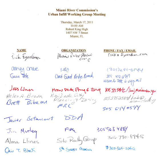
March 17, 2011 | THIS IS A PUBLIC DOCUMENT
The Miami River Commission’s (MRC) Urban Infill Working Group (UIWG) convened a public meeting on March 17, 2011, 10 AM, at the Robert King High Classroom, 1407 NW 7 Street. UIWG Chairman Jim Murley chaired the meeting and attendees provided self-introductions. The UIWG accepted the February 15, 2011 UIWG meeting minutes. The attendance sheet is enclosed. |
I. Projects
A. Presentation of New “Big Fish” Proposed Plans, 55 SW Miami Avenue Road- Mr. Brett Bibeau, MRC Managing Director, stated he had received the following email yesterday evening from Mr. Ben Fernandez, Bercow Radell & Fernandez, “Brett, unfortunately we were not able to obtain the write up. We would like to withdraw the item from the Infill Group’s agenda tomorrow and ask that you reschedule it for the next meeting.” The UIWG agreed to invite Mr. Fernandez to the May 17 UIWG meeting, 9 am at the Robert King High Board Room, 1407 NW 7 Street.
B. Update of Miami-Dade Transit’s Metrorail Airport Link and M-Path Project -UIWG Chair Murley welcomed Ms. Rosalyn Contreras, Public Information Officer for MDT-CEI Airport Link, and Miami-Dade Transit (MDT) staff, whom provided a construction update. MRC staff provided Ms. Contreras copies of the UIWG February 15 and March 17, 2011 public meeting minutes in which this item was presented. Ms. Contreras reported construction of the structures/segments along the north side have been completed. Ms. Contreras noted construction of the structures/segments along the south side is commencing today and will require the operation of a barge along the river. Ms. Contreras added the county has sufficiently coordinated this effort with adjacent river property owners.
Ms. Contreras provided copies of the revised “Figure 2B: Parcel 312 MIC-EH Pond-Modified Design” and noted a portion of this site (far eastern end) is currently being leased to Betty K Agencies. Ms. Contreras added the remaining available space will be put up for future lease. Ms. Contreras noted the original design had included a drainage pond and landscaping, which have since been eliminated and the area will now become available for lease for marine industrial business usage. Mr. Surinder Sahota, MDT, explained the drainage had been relocated in order to create a plain-level area. Mr. Manual Garcia, CEI/MDT, stated a fence line would be installed at Parcel 312 to separate the MDT portion (west of fence) from the land available for lease (east of fence). Mr. Sahota noted a Request for Proposals (RFP) would be issued to begin the process of leasing the remaining available space on Parcel 312.
Mr. Bibeau cited the “FPL easement” (located east of the proposed fence line) on the distributed modified design, and asked how high the power lines would be. Ms. Contreras noted the power lines are already in place and deferred to Mr. Garcia to provide additional information. Mr. Garcia explained the transmission lines are slightly higher than the “guideway,” but lower than the 75-foot vertical clearance. Mr. Bibeau asked why the lines weren’t installed beneath the river, and Mr. Sahota replied he believed FP & L had decided to install the lines above ground due to the transmission level: 130 kv, yet noted some distribution lines had been installed beneath the river. Mr. Sahota added all line relocation work had been completed. Mr. Bibeau asked how FP & L was able to obtain permission from the federal government to have the lines installed below the designated 75-foot clearance level, and Mr. Sahota replied he would need to provide Mr. Bibeau with the contact information for the FP & L representative whom would be better suited to address this question.
UIWG Chair Murley suggested contacting the South Florida Regional Transportation Authority to obtain an update regarding the future Tri-Rail project which may impact the surrounding area. In addition, UIWG Chair Murley recommended MRC staff to continue gathering information on MDT’s Metrorail Airport Link and M-Path Project, especially from FP & L.
UIWG Chair Murley stated the MIC-Earlington Heights Metro-Rail Extension project is progressing as previously recommended by the MRC, and consistent with previous MDT written commitments. UIWG Chair Murley noted he would like to invite MDT to present this project as an informational update item at the June 6 Miami River Commission board meeting, noon, Robert King High, 1407 NW 7 Street, and MDT kindly accepted.
Ms. Contreras deferred to Mr. Orlando Capote, MDT, to provide an update regarding improving the “M Path” (Pedestrian Walkway) to connect Miami-Dade Public Works’ planned riverwalk beneath Metro Rail’s North Shore to the adjacent Southwest Third Street. Mr. Capote distributed a 1994 aerial depicting the former existence of the M-Path columns and guideway, which were wiped out during construction of the adjacent development, Mint and Ivy. Mr. Capote stated MDT intends to continue their research of this item and later contact the developer of Mint/Ivy to request that they repair the damage they caused and address their current encroachment on county property.
Following completion of the project, Mr. Bibeau noted Public Works had pledged to repair the bulkhead/seawall that had fallen into the river (in the form of big concrete slabs) from the property in which the county imminent domains on the Miami River, and Mr. Capote replied this was correct. In addition, Mr. Capote noted the county would then remove the fences along 3rd Street in order to connect the public riverwalk to the closest sidewalk on SW 3 ST. Mr Capote stated if the developers whom used MDT public ROW during construction do not repair the M-Path to its previous functional condition, then when the revised cost estimate is provided in a few months for the M-Path repairs, and if it is under budget, then the leftover funding would be used to repair this additional portion of the M-Path, on the north shore of the River. Mr. Bibeau noted the planned greenway will eventually connect to the east at the existing public riverwalk at Mint (via Mint’s agreed donation of a portion of their land to the county) and to the west to the existing public riverwalk at the FP & L site. UIWG Chair Murley thanked MDT for their great progress and stated he looked forward to providing this update to GSC Chair Ernie Martin. UIWG Chair Murley offered Mr. Bibeau’s assistance on this item and suggested that the MRC send a letter to Assistant County Manager Ysela Llort to thank her for MDT’s progress.
UIWG Chairman recommended the MRC find MDT’s proposed “M Path” (Pedestrian Walkway) repairs to connect Miami-Dade Public Works’ planned riverwalk beneath Metro Rail’s North Shore, to the adjacent Southwest Third Street, consistent with the Miami River Corridor Urban Infill Plan and Miami River Greenway Action Plan.
C. Review of Transportation Improvements to Alleviate Temporary Vehicular Congestion at Miami River Drawbridge Openings - MRC staff distributed the March 17, 2011 UIWG meeting minutes in which this item was discussed and the document, “Action Items to Alleviate Temporary Vehicular Congestion at Miami River Drawbridge Openings – April 11, 2011 Draft:”
1) Meet with drawbridge operators – Status: MRC scheduling meeting to discuss drawbridge operations with drawbridge operators, marine industrial businesses, FDOT, USCG, MDC PW, Florida Drawbridge, DDA, MRMG, etc. on May 17, 9 AM, 1407 NW 7 ST.
2) MRMG consultant starts “CommandBridge” – Status: operations commence estimate July 2011
3) MDC restripes 17 Ave North bound, from south of the I-836 overpass to the Bridge, in order to double the lane capacity from 1 to 2 vehicular lanes – Status: MDC meeting with MDX this week
4) Lights on bridges for boats (red stop and green go) – Status: Operational
5) Smart signage warning motorists of upcoming bridge openings and suggesting alternate routes – Status: MRC communicating with USCG, FDOT, and MDC
6) Incorporate FDOT’s 511 - Status: MRC communicating with FDOT
7) Planned Brickell Ave turning lane improvements - Status: construction estimated 2012
8) Distribute information regarding when to expect bridge openings – Status: MRC preparing draft, and reaching out to DDA, Brickell Area Association and Brickell Homeowners Association to partner on distribution
UIWG Chair Murley noted he had forwarded MRC staff an email exchange between himself and Mr. Gene Glotzbach, Intelligent Transportation Systems Section of FDOT’s Traffic Engineering and Operations Office, regarding FDOT’s 5-1-1 system (action item #6). UIWG Chair Murley noted Mr. Glotzbach’s primary two suggestions were as follows;
“1. If there is a major breakdown of a bridge, e.g. stuck in up position, then that situation can be relayed to FL511 and they can add it to their recording a “Floodgate” message that all callers will hear first when they connect with FL511.
2. In terms of providing daily operational information on the bridges the possibility exists that the FL511 system could include a query for “Miami River Bridge” that would then trigger a connection to an independently operated phone number that can give current information on the bridges. The FL511 website can also provide a link to an independently run website that can give updated information on the bridges.”
MRC staff agreed to research FDOT’s website, www.fl511.com for further information.
D. Update of Miami Marlins Ballpark - Mr. Bibeau distributed a Miami Herald article regarding an item on today’s Miami City Commission meeting agenda that proposes to develop a trolley transportation system within certain parts of the City, including the Health District/Marlins Ballpark area. In addition to trolleys, Mr. Bibeau noted Marlins representatives are considering a variety of transportation initiatives, such as water taxis/buses, bicycle, pedestrian and vehicular improvements, etc. Mr. Bibeau added the Miami Parking Authority has issued an RFP to fill out the public retail space located on the ground level of the stadium.
II. Plans
A. Review of City of Miami’s 2012 Evaluation Appraisal Report – UIWG Chair Murley suggested reviewing the City’s past EAR in order to re-familiarize the UIWG with former initiatives and prioritize a future course of action.
Ms. Helen Brown, Miami-Dade County Department of Planning & Zoning, noted the county’s EAR was recently adopted, and per the request of Mr. Bibeau, agreed to forward MRC staff a link to the final, adopted EAR.
B. Update of Miami-Dade County Palmer Lake Charrette- The UIWG welcomed Mr. Jess Linn and Mr. Eric Silva, Miami-Dade County Department of Planning and Zoning, and provided them with copies of the UIWG March 17, 2011 and MRC April 4, 2011 meeting minutes, as well as the following document:
“Final plan adopted by the Palmer Lake Steering Committee should be submitted to the MRC for review by appropriate public subcommittee and subsequent final action at public MRC meeting.
Recommendation to approve the 1st draft Palmer Lake Plan, with the following revisions:
1) Page 25, under “Bertram property” section, insert following new sentence, “Bertram Yachts generated 150 jobs on this site for decades, and a new recreational boatyard / boat manufacturer remains an option for the future of this area.” Considering this waterfront site is one of the few parcels included in the Palmer Lake Plan’s “Marine Industrial Area”, and the County’s Adopted Comprehensive Plan includes the Bertram Yachts site in the Marine Industrial category, delete references to non-marine industrial uses, ie big box retail, etc.
2) In the “Marine Industrial Area” section, pages 37-40, insert following new sentence and insert into page 48, “The 1941 Tamiami Canal Swing bridge needs to be replaced with a new bascule bridge.”
3) In the “Marine Industrial Area” section, pages 37-40, insert following new sentence and insert into page 48, “Conduct the Tamiami Canal Maintenance Dredging and Environmental Cleanup project, from the salinity dam to the Miami River’s recently dredged federal navigable channel.”
4) In the “Marine Industrial Area” section, pages 37-40, insert following new sentence and insert into page 48, “Implement multi-modal freight transportation, linking Port of Miami River, Railroad, Airport, and Port of Miami.”
5) Page 37, under “NW South River Drive”, revise first sentence, “Designated as part of the Miami River Greenway, NW South River Drive and NW 25 ST from South River Drive to Douglas Ave, should be constructed to provide sidewalks, landscape, strips, curbs, gutters, bike lanes, and two through travel lanes.”
Page 38, revise caption, “Left, NW South River Drive and NW 25 ST from South River Drive to Douglas Ave, is transformed with the addition of parallel parking, curbs, consistently planted street trees, and bike lanes.”
Page 48, under “Marine Industrial Area” amend the 2nd line item , “Reconstruction of NW South River Drive, and NW 25 ST from South River Drive to Douglas Ave, providing bike lanes, on-street parking, sidewalks, and landscaping.”
6) Page 37, 1st paragraph, last sentence currently states, “Other marine related uses not already permitted by existing zoning districts in the area should be allowed as well”, should be either clearly defined or deleted.
Page 48, under “Marine Industrial Area” the 1st line item currently states, “Permitting of marine-related uses not already allowed”, should be either clearly defined or deleted.
Page 48, under “Implementation” the 1st line item currently states, “Zoning Code Amendments implementing plan recommendations”, should be either clearly defined or deleted.
Insert the area’s applicable existing Zoning and Land Use Laws
7) Insert “Include electric car plug in stations on public sector owned sites within the study boundary.” (As recommended by Ms. Sallye Jude at the MRC April 4, 2011 meeting)
Mr. Linn stated he had no new information to report on this item other than he had made a presentation to the MRC on April 4 and is currently compiling comments/recommendations being received for the draft plan which will be forwarded to the Palmer Lake Steering Committee. Mr. Linn noted the Palmer Lake Steering Committee is scheduled to review the current draft plan again on Monday, May 16, 3 pm, Orlando Urra Allapattah Neighborhood Center, 2257 NW North River Drive, including any submitted proposed amendments, and would send via email an invitation in the near future. Mr. Bibeau noted Mr. Linn had reported at the MRC April 4 and March 17 UIWG meetings that the Palmer Lake Steering Committee meeting would be held on May 10, and respectfully recommended that the new date be emailed today in order to avoid confusion.
GSC Chair Martin recommended the creation of a Community Redevelopment Agency (CRA) as a potential implementation strategy in order to generate funding for Palmer Lake. Mr. Bibeau explained the potential creation of a CRA is mentioned in the draft plan (pages 45-46) as a possible implementation strategy, and therefore is not needed on the summary of MRC recommend revisions to the draft plan. Therefore Mr. Bibeau offered to vote on it as a top priority item at the May 16 Palmer Lake Steering Committee meeting in his capacity as Vice-Chair of the Steering Committee and as Managing Director of the Miami River Commission.
Mr. Bibeau asked if MDC staff has any feedback to report in regards to the distributed MRC recommendation list, and Mr. Linn and Mr Silva replied there did not seem to be anything controversial and would forward all comments to the Steering Committee. Mr. Linn explained any recommendations that are subsequently presented to the Board of County Commissioner-following the Steering Committee’s review-must be consistent with the county’s comprehensive plan and considered feasible.
Ms. Alma Llinas, realtor, noted a few of her clients, whom happen to be Miami River property owners, are concerned about the future impact the Palmer Lake plan may have on their properties and have therefore enacted 10-year leases. Mr. Linn noted the current draft plan thus far only consists of recommendations, and therefore, the status of such businesses/properties may or may not change.
Mr. Bibeau noted one of the Steering Committee’s members had emailed their suggested changes to the draft plan, and asked if MDC staff would distribute the MRC’s provided recommendations to all Steering Committee board members prior to the May 16 meeting. Mr. Silva replied he would send any and all recommendations to board members in advance of the meeting.
Mr. Bibeau thanked Mr. Silva for providing the existing zoning chapters and asked for further clarification on retail as an allowable use. Mr. Linn explained that retail is permitted (such as in the form of a “warehouse club”) if goods are stored or manufactured on premises and more than 50% of the total floor area is dedicated to manufacturing/warehousing.
UIWG Chair Murley thanked Mr. Linn and Mr. Silva for their presentation and invited them to the May 17 UIWG meeting for a future update.
III. New Business - No items were addresses/discussed. The meeting adjourned.
|
April 14, 2011 | THIS IS A PUBLIC DOCUMENT
Miami River Commission’s (MRC) Urban Infill Working Group (UIWG) convened a public meeting on April 14, 2011, 10 AM, at the Robert King High Classroom, 1407 NW 7 Street. UIWG Chairman Jim Murley chaired the meeting and attendees provided self-introductions. The UIWG accepted the March 17, 2011 UIWG meeting minutes. The attendance sheet is enclosed. |
I. Projects
A. Review of Transportation Improvements to Alleviate Temporary Vehicular Congestion at Miami River Drawbridge Openings - UIWG Chair Jim Murley welcomed meeting attendees and explained this item has been placed on the agenda for discussion per the official request of the Honorable City Commission Chairman Gort and Honorable Mayor Regalado. UIWG Chair Murley noted this item is very important to everyone who lives and works along the Miami River, and had therefore invited a group of unique individuals today to help obtain further understanding of drawbridge operations. UIWG Chair Murley noted the Miami River Commission had been directed to partner with the Miami River Marine Group to develop ways to improve interaction among vessels under tow, recreational boaters, vehicular and pedestrian traffic.
UIWG Chair Murley asked MRC board member Javier Betancourt, Miami Downtown Development Authority (DDA), if he would like to share his input, and Mr. Betancourt recalled this item has been discussed at previous meetings and it is the DDA’s perspective that bridge openings impact the Downtown area. Mr. Betancourt explained this impact will become greater as development continues to flourish and Downtown evolves into a “24-7” destination.
Mr. Bibeau noted he had reviewed the Federal Register and wondered what percentage of the time does the Brickell Bridge open on the hour and half hour, in between the three lockdowns. Mr. Sonny Hobson, Florida Drawbridge, replied he believed 85% of the time. Mr. Bibeau stated it was therefore safe to assume and expect Brickell Bridge openings at those specific times. Mr. Bibeau noted MRC staff had distributed the document, “Action Items to Alleviate Temporary Vehicular Congestion at Miami River Drawbridge Openings – April 11, 2011 Draft” at the April 14, 2011 UIWG public meeting. Mr. Bibeau noted one of the action items is: “Distribute information regarding when to expect bridge openings- Status: MRC preparing draft, and reaching out to DDA, Brickell Area Association and Brickell Homeowners Association to partner on distribution.” Mr. Bibeau stated he believed if commuters were made aware of drawbridge opening times, they would potentially seek alternate traffic routes which could in turn help alleviate vehicular congestion.
UIWG Chair Murley asked how many drawbridges are currently in operation along the Miami River, and Mr. Yaroslav Concepcion, Florida Department of Transportation (FDOT), replied 10: 6 are owned, operated and maintained by the State (FDOT) and 4 are owned, operated and maintained by Miami-Dade County Public Works. Mr. Hobson noted Florida Drawbridge has a contract with the State to oversee their 6 drawbridges. Mr. Michael Lieberum, U.S. Coast Guard, added all these bridges are subject to Coast Guard regulation.
Mr. Rick Eyerdam, Miami River Marine Group, asked if there are a set of guidelines/procedures in place for bridge operations, and Mr. Lieberum replied Title 33 “Navigation & Navigable Waters” CFR (Code of Federal Regulations) defines the procedure for bridge openings. UIWG Chair Murley asked if bridge tenders utilize any supplementary guidelines, and Ms. Laura Porter, Florida Drawbridge, replied her organization abides by Coast Guard regulations (in terms of bridge openings and closings) as well as a supplementary guideline defining safety procedures for pedestrians and vehicles. Mr. Jose Cebey, Miami-Dade County, noted the County’s bridge operators, whom are County employees, utilize the same safety procedures. Mr. Eyerdam asked if these safety procedures dictate the interval/timing of bridge openings and closings, and Mr. Jon Grams, Florida Drawbridge, replied a boat typically has to pass/clear the fender system before a bridge can close. In terms of abiding by bridge rules and regulations, Mr. Eyerdam asked if there was a notable difference between commercial and recreational boaters, and Mr. Hobson replied he believed recreational boaters did not comprehend the rules as well as professional boaters. Miami-Dade County and FL Drawbridge offered to provide copies of the written bridge operator guidelines to the MRC.
Mr. Lieberum noted a Coast Guard Reservist from his office was trying to track down as many boaters as he could to encourage them to lower their outriggers and antennas so that they would not require bridge openings. Mr. Lieberum explained the only reporting mechanism the Coast Guard has are bridge tenders, and the only information they are able to obtain is the name of the vessel and its home port (boat captains typically do not provide vessel information to bridge tenders). Mr. Lieberum added bridge tenders are not always able to obtain FL numbers, as they are located at the side of the haul away from the bridge tender’s view. Mr. Lieberum noted if the bridge tender is able to forward a FL number (boat registration number) to the Coast Guard, it’s still a difficult task to track down the proper owner because these numbers are usually associated with more than one registered person.
UIWG Chair Murley asked for clarification on an “unauthorized” bridge opening, and Mr. Lieberum explained that boaters may be subject to both criminal and civil penalties (up to a $25,000 fine) for causing what the Coast Guard refers to as an “unnecessary” bridge opening. An “unnecessary” bridge opening is caused when a vessel has the ability to lower their antennas or outriggers to pass beneath the bridge safely yet chooses not to do so, thereby requesting a bridge opening. All “unnecessary” bridge openings are reported to the Coast Guard.
UIWG Chair Murley asked if there are any signs posted along the river alerting boaters of these penalties, and Mr. Hobson replied signs are posted at some of the bridges regarding the possibility of incurring fines if regulations are violated. UIWG Chair Murley recommended finding a more cohesive way to alert and inform boaters. Mr. Eyerdam noted he had suggested at previous meetings reaching out to boating websites and publications to further awareness on this issue.
Mr. Eyerdam asked if there are cameras monitoring boat passage beneath the Miami River’s bridges, and Mr. Hobson replied there are a few cameras, yet they only show the vessel itself- no name, FL number, etc. Mr. Eyerdam offered to obtain and install better cameras as part of the Miami River Marine Group’s “CommandBridge” initiative. Mr. Concepcion stated he would need to research if the installation of such cameras is legal and feasible.
Mr. Lieberum explained if a recreational boater requests an “emergency bridge opening” (during curfew/lockdown times), the bridge tender is required to open the bridge yet must report this opening to the Coast Guard. Mr. Lieberum added the Coast Guard in turn conducts an investigation to determine if the opening was truly due to an emergency. If it is discovered that there was no such emergency, a fine will be imposed. Mr. Lieberum added if a bridge tender refuses to open a bridge during a true emergency, the Coast Guard can be fined $25,000.
Mr. Bibeau asked for the number of recent “emergency bridge openings,” and Mr. Hobson replied there may be one every couple of months. Mr. Grams reported there were two emergency bridge openings last month at the NW 5th Street Bridge (one example was a vessel taking on water), yet there usually aren’t many.
Mr. Bibeau noted all bridges along the Miami River have four bridge arms, except for the NW 5th Street Bridge which has eight. Mr. Bibeau stated he believed that for this very reason (8 arms going up and down, one-at-a-time), the NW 5th Street Bridge takes the longest time to open and close. Mr. Bibeau suggested four of these arms be removed so that the bridge can operate like all the others, and Mr. Concepcion replied this was actually a design and safety question he would need to forward to FDOT.
Mr. Grams stated the biggest factor that “holds up” a bridge happens to be pedestrians. In addition, Mr. Grams noted bridge tenders need to make sure all vehicular traffic has stopped at the light. Mr. Grams added the average bridge opening time at the NW 5th Street Bridge is seven minutes. Mr. Bibeau asked for the average time of the Brickell Bridge, and Mr. Hobson replied five minutes. UIWG Chair Murley asked if there is any signage alerting pedestrians of bridge protocol, and Mr. Hobson replied there are signs indicating when they need to stop (i.e. can’t walk across the bridge). Mr. Bibeau added there are also arms, lights and bells indicating bridge openings. Mr. Hobson stated the installation of pedestrian gates (similar to those present at the 2nd, 12th, and South Miami Avenue Bridges) could help speed up bridge openings. Mr. Bibeau asked where these gates would be installed, and Mr. Hobson replied along the sidewalk adjacent to the bridge. Mr. Lieberum noted pedestrian gates can complicate matters when not operated and maintained properly. Mr. Bibeau asked if a pedestrian bridge has ever broken causing an issue, and Mr. Lieberum replied yes. The attendees agreed to further explore the pros and cons of the installation of pedestrian gates at all Miami River bridges (new action item #9).
The UIWG reviewed the document, “Action Items to Alleviate Temporary Vehicular Congestion at Miami River Drawbridge Openings – April 11, 2011 Draft:”
1) Meet with drawbridge operators – Status: MRC conducted public meeting to discuss drawbridge operations with drawbridge operators, marine industrial businesses, FDOT, USCG, MDC PW, Florida Drawbridge, DDA, MRMG, etc. on May 17, 9 AM, 1407 NW 7 ST.
2) MRMG consultant starts “CommandBridge” – Status: operations commence estimate July 2011
Mr. Eyerdam noted a Memorandum of Agreement (MOA) has been prepared and needs to be voted on by the Board of County Commissioners (preferably before the August recess yet after the upcoming Mayoral election). Mr. Eyerdam noted that once the MOA is approved, he will be able to approach condominium associations/boards to negotiate video camera installation. Mr. Eyerdam added his goal is to have the “CommandBridge” software up and running by July 2011, if not before.
3) MDC restripes 17 Ave North bound, from south of the I-836 overpass to the Bridge, in order to double the lane capacity from 1 to 2 vehicular lanes – Status: Mr. Bibeau noted Mr. Manny Garcia, Chief of Miami-Dade County Public Works, had scheduled a meeting with Miami-Dade Expressway Authority (MDX) to coordinate this effort, and was looking forward to learning the outcome of this meeting.
4) Lights on bridges for boats (red stop and green go) – Status: Mr. Lieberum noted the Coast Guard tested this system in the Florida Keys, and found it to be confusing to many boaters, thereby creating more delays. Mr. Bibeau noted the Brickell Bridge currently has this lighting system. The light is red when the bridge is closed or half-way open, and green when the bridge is fully open, allowing boaters to pass through. Mr. Lieberum explained there is no signage indicating the specific meaning of these lights at the Brickell Bridge, which can complicate matters. For example, if a smaller vessel, which does not need a bridge opening, sees the red light, they often unnecessarily stop. Attendees agreed to remove this action item from future lists.
5) Smart signage warning motorists of upcoming bridge openings and suggesting alternate routes – Status: MRC communicating with USCG, FDOT, and MDC
Mr. Bibeau suggested creating a simple mechanism bridge tenders can utilize prior to a bridge opening to indicate the direction a vessel is traveling. Mr. Bibeau explained this mechanism could provide commuters with a specific alternate route via an integrated smart signage system. Mr. Bibeau added that perhaps this mechanism can be in the form of a button: one button can be pushed to indicate east-bound, and the other for west-bound. Ms. Porter noted she would be willing to consider this idea-should it be a simple as “pushing a button.” Mr. Cebey noted the County currently utilizes static signs, but would be amenable to this idea. Mr. Lieberum noted the exploration of this mechanism may require an extensive traffic study. Mr. Concepcion stated he would forward Mr. Bibeau’s suggestion to FDOT’s Traffic Office.
Mr. Lieberum suggested extending the duration of green traffic lights at Brickell Avenue once the bridge goes down in order to promote a smoother traffic flow and alleviate congestion. Attendees agreed to add the following as a potential action item: “Synchronize light timing on traffic lights between Brickell Ave and the Brickell Bridge, to allow extended green lights after bridge openings.” (new action item #10) Mr. Concepcion agreed to forward this recommendation to FDOT.
6) Incorporate FDOT’s 511 - Status: MRC communicating with FDOT
UIWG Chair Murley stated FDOT had emailed him that FDOT would be willing to include Miami River Drawbridge openings in the 511 system, but would need an outside online system to provide the needed updated / current Miami River drawbridge opening information to be forwarded on via the 511 system. Mr. Eyerdam noted the “CommandBridge” software will be able to alert motorists of impending bridge openings. Mr. Eyerdam explained the “CommandBridge” program transmits images of maritime traffic (in real time online via a set of installed cameras and data sources) to a server which then generates alerts to subscribers over the internet, thereby providing motorists time to identify alternate travel routes. Mr. Eyerdam noted users could include law enforcement officials, Coast Guard, condo associations, hotels, etc. Mr. Concepcion asked if FDOT will be provided a copy of the operational software for review, and Mr. Eyerdam replied yes and may serve as the host site for the FDOT’s 511 system. Mr. Betancourt noted that perhaps an IPhone Application could be created to alert commuters of bridge openings. Mr. Bibeau asked if bridge tenders have internet access, and Ms. Porter replied no.
7) Planned Brickell Ave turning lane improvements - Status: Construction estimated 2012
Attendees reviewed a 2/27 Miami Herald Article which states the designed and funded project includes:
-
“Increasing the lengths of the left turn lanes on Birckell Avenue for northbound traffic at 5th and 7th Streets
-
Increasing the lengths of the left turn lanes on Brickell Avenue for southbound traffic at 7th and 8th Streets
-
Converting the northbound outside lane at SW 8th Street from an exclusive right-turn-only lane to a thru and right turn lane.
-
Installing new signs and traffic signals and optimizing signal timing”
Mr. Betancourt noted the DDA is supportive of the aforementioned portions of the project, which is estimated to commence in 2012.
8) Distribute information regarding when to expect bridge openings – Status: MRC reaching out to DDA, Brickell Area Association and Brickell Homeowners Association to partner on creation and distribution of informational items. Mr. Bibeau noted this informational brochure or pamphlet can include bridge opening times and the importance of abiding by bridge rules (i.e. notifying pedestrians when and where to stop). Mr. Betancourt noted the brochure should also explain how Miami River Bridges impact hundreds of ports of call and local marine industrial businesses (the rationale behind bridge openings, tides, Cruise vessel traffic, etc.). Ms. Porter suggested creating a public awareness campaign or slogan to teach pedestrians and motorists these general bridge rules.
Mr. Eyerdam noted he had previously reported that Channel 51 is working on a documentary about the daily operations of tug boats along the Miami River, and upon completion would ask the City of Miami to air it on their public TV channel so that audiences can obtain an understanding of vessel traffic along the Miami River. Mr. Eyerdam noted he had asked Mr. Betancourt if the DDA would consider co-funding this initiative, and Mr. Betancourt stated he would look into this.
Mr. Hobson provided the following curfew /lockdown times for the Brickell Avenue Bridge (Monday-Friday except for Holidays):
-Morning Lockdown: 7:35 am-8:59 am (Monday through Friday)
-Lunch Lockdown: 12:05 pm-12:59 pm (Brickell, South Miami and 2nd Avenue Bridges)
-Evening Lockdown: 4:35 pm-5:59 pm (Monday through Friday)
Mr. Hobson added in between these three lockdowns, the Brickell Avenue Bridge opens only on the hour and half-hour. Mr Hobson noted due to public safety, tugs and vessels under tow are exempt. Mr. Rodriguez, P&L Towing, stated the Miami River’s 2 tug boat companies and numerous international shipping terminals have voluntarily agreed to try to avoid bridge openings at peak vehicular times to the best of their ability, considering they do not control tides, Cruise schedules in the Port of Miami, Pilot Curfews, and other factors which impact the schedule.
UIWG Chair Murley suggested creating a matrix to highlight curfew and bridge opening times for all Miami River Bridges. Mr. Concepcion stated he would provide MRC staff with FDOT’s informational bridge brochure.
Mr. Betancourt asked if it would be possible to extend Brickell’s hour and half-hour opening rule to all the Miami River’s Bridges. Attendees noted that had been previously studied in 2005 when the additional lunch hour lock down, and hour & half–hour openings for the Brickell Bridge and noted if all bridges were bound by the hour and half hour openings, it would take hours for a vessel to navigate the Miami River. Mr. Betancourt stated he now understood why it’s not feasible to do so.
Mr. Lieberum noted P & L Towing had “cut their tugs” to make them shorter in order to allow them to navigate beneath more bridges without requiring an opening, which was quite an expensive process.
UIWG Chair Murley thanked everyone for their participation, and noted the UIWG would schedule future follow-up meetings.
II. New Business - Mr. Bibeau provided an update of the following items:
-
Mr. Bibeau thanked FDOT for repairing all lights along the riverwalk beneath the Brickell Bridge
-
Mr. Bibeau stated the Federal shipbuilding grant is opening a 2nd funding cycle, therefore he forwarded the Fed Register to the 2 Miami River businesses, Jones and Merrill-Stevens Boatyards, which applied in the first round a couple years ago, and were denied funding
-
“Big Fish” 55 SW Miami Avenue Road, has yet to receive its City of Miami zoning write up, and will scheduled at UIWG and MRC after it has been provided
Mr Bibeau reported the Miami City Commission agenda recently had a discussion item regarding the possibility / considering asking the County to annex to the City of Miami the Upper River area, which is currently located in unincorporated Miami-Dade County. UIWG Chair Murley asked MRC staff to monitor the item. The public meeting adjourned.
|
May 17, 2011 | THIS IS A PUBLIC DOCUMENT
The Miami River Commission’s (MRC) Urban Infill Working Group (UIWG) convened a public meeting on May 17, 2011, 9 AM, at the Robert King High Boardroom, 1407 NW 7 Street. UIWG Chairman Jim Murley chaired the meeting and attendees provided self-introductions. The UIWG accepted the April 14, 2011 UIWG meeting minutes. The attendance sheet is enclosed. |
I. Projects
A. Presentation of New “Big Fish” Proposed Plans, 55 SW Miami Avenue Road - The UIWG welcomed Mr. Ben Fernandez, Bercow, Radell & Fernandez, and project architect D.B. Lewis, DB Lewis Architecture & Design, whom presented a revised proposal for a two-story restaurant (3rd Floor Terrace) and VIP lounge at the former site of Big Fish restaurant, 55 SW Miami Avenue Road, west of the South Miami Avenue Bridge on the south bank of the Miami River.
Miami River Greenways Subcommittee (GSC) Chair Dr. Ernie Martin noted he believed the City of Miami’s Planning & Zoning Appeals Board (PZAB)-on which he serves-is expected to consider proposed variances for Big Fish. Attendees noted this public meeting was publicly noticed and similar to previous meetings, Mr. Fernandez and Mr Lewis stated they had no objections to Dr. Martin participating in MRC’s public meetings and then eventually voting on this project as a PZAB member. Mr. Fernandez stated he was not sure if Big Fish would be presented to the PZAB in July or September, but noted City of Miami Planning Director Francisco Garcia had recommended the project firstly be presented to the City of Miami Waterfront Advisory Board (WAB) on July 12. Mr. Fernandez stated according to this timeline, Big Fish maybe presented to Miami City Commissioners as early as September 2011.
MRC Managing Director Brett Bibeau thanked Mr. Lewis for emailing the revised plans for Big Fish on Friday, June 24. Mr. Lewis stated the developers of Big Fish are currently working on a variety of initiatives in anticipation of the project: 1) construction of the seawall; 2) Miami-Dade Water and Sewer Department has recently granted them approval to replace the water main; 3) obtaining final approval for platting/tract; and 4) undergrounding utilities. Mr. Lewis noted all initiatives are being performed at the cost of the developer.
Mr. Lewis noted the estimated 53-foot narrow site (52 feet, 7 inches) will have two-story restaurant (3rd Story Terrace) and VIP lounge (with a modern European nautical influence), an amenity plaza, and a publicly accessible 12-foot-wide unobstructed/ADA-accessible riverwalk along the Miami River. Mr. Lewis noted the previously presented 12-room luxury boutique hotel component is no longer being proposed.
Mr. Lewis noted the developer is requesting a front yard setback variance to allow 0 feet (where 10 feet is normally required). Mr. Lewis explained the original Big Fish structure, which was demolished by the developer, was a non-conforming structure with a front yard setback variance as well.
Mr. Lewis noted public pedestrian and bicycle access will be established on both sides of the property. Mr. Lewis noted five feet will be provided on the east side yard (South Miami Avenue Bridge side) and eight feet will be provided on the west side yard (i.e. three feet of landscaping and five feet of public walkway).
Mr. Lewis noted the developer heeded the previous recommendation of the MRC to “incorporate more detail / develop a design solution for the center courtyard in order to help the public understand that it is indeed open to the public and make it as inviting as possible” (June 7, 2010 MRC meeting minutes), and has therefore replaced the wall at the center courtyard/amenity plaza with a 12-foot transparent gate that can be opened and closed.
UIWG Chair Murley stated the goal is to activate the property as much as possible via the integration of the forthcoming construction of the City of Miami on-road greenway (South Shore Metro Rail to South Miami Avenue Bridge) and the proposed publicly accessible riverwalk at Big Fish. Attendees noted the revised proposed plans now seek a revision to the City’s 100% complete construction engineering documents for the on-road Miami River Greenway along the adjacent street’s public right of way. Due to FEMA flood elevation requirements, the new proposed Big Fish buildings need to be constructed an estimated 4 feet above the level of the street and on road-Greenway. Therefore Big Fish developers are asking the City to amend their construction engineering documents, to have the landscaping zone be on a four foot incline and the developers will pay for a ADA ramp, with the 8’wide sidewalk at the same elevated level as the entrances to the restaurant buildings.
UIWG Chair Murley asked Mr. Lewis to illustrate the public access points (via the sidewalk) at the Big Fish site, and Mr. Lewis noted a series of differing grading levels were employed to make public accessibility as smooth and inviting as possible. For instance, the eastern side yard/sidewalk slopes/ramps up to 5.67 feet (NGVD), then up again to a 9-foot grade before sloping back down to 5.5 feet. By incorporating this system, Mr. Lewis noted a staircase is no longer needed along the eastern side yard. Mr. Lewis noted this sort of sloping system will also be incorporated in the western side yard. UIWG Chair Murley asked if signage indicating a publicly accessible riverwalk could be incorporated in the plans, and Mr. Lewis replied yes.
UIWG Chair Murley asked if the site would have bike racks, and Mr. Lewis replied he was not sure if the City of Miami is already incorporating bike racks in their on-road greenway plans for the area. Mr. Fernandez noted valet parking will be provided at a lot near Big Fish, and he anticipated that the upcoming Brickell Centre project would also provide ample parking in the neighborhood.
Mr. Bibeau noted the City Charter typically requires a 50-foot waterfront building setback-unless the depth of the lot is less than 250 feet. Mr. Bibeau explained if a property is less than 250 feet, the setback shall be at least 25 percent of the total lot depth (from sidewalk to shoreline). According to the recent City of Miami “Zoning Write-up/Interpretation Letter” for Big Fish, the required waterfront setback is 13 feet, 6.4 inches, yet a waiver is being requested to bring this down by 4.6 inches-making the total proposed waterfront setback to 13 feet, 1.8 inches. Mr. Bibeau stated it was his understanding that it was previously agreed to maximize the clear, unobstructed public pedestrian path / riverwalk as much as possible. Mr. Lewis explained the riverwalk has nine feet and one ¾ inches of clear public “circulation zone” path and a four feet Safety Zone including lights and landscaping. Mr. Bibeau noted that according to Miami 21 “Appendix B: Waterfront Design Guidelines-Safety Buffer Zone is depicted as 3-4 foot-wide, within the standard 25 foot wide riverwalk. Therefore Mr. Bibeau recommended bringing the proposed four-foot safety zone down to the allowable three feet in order to add an extra foot and make the unobstructed circulation zone 10’-2”. Mr. Lewis explained the four-foot safety zone includes the required landscaping and therefore believed he could not deduct one foot from this area, as required by Mr. Dakota Handon, City of Miami Planning Department. Mr. Bibeau noted perhaps 3’ wide decorative planters maybe used for the trees
Mr. Bibeau noted the City of Miami “Zoning Write-up/Interpretation Letter” for Big Fish requires a side yard setback of 69 feet, yet a waiver is being requested to bring this down by 59 feet -making the total proposed side setback 10 feet. Mr. Bibeau cited section A2.01B of the Big Fish Restaurant site plans which depicts only a five foot circulation zone, of which 2 feet depicts landscaping and lights, leaving only a 3’ wide unobstructed public riverwalk pathway. Mr. Bibeau asked if there was any way to make this section of the riverwalk the same as the wider proposed section depicted on page A2.01A, with the revision to decrease the safety zone to 3 feet in order to increase the unobstructed circulation zone to 10’ – 2”. Mr. Fernandez and Mr. Lewis replied that due to the changes in elevation of the 13-foot setback, this effort would be quite difficult but agreed to look into it.
Mr. Bibeau stated he was concerned about the proposal to use the Miami River Greenway’s unobstructed circulation zone / sidewalk as a 180 degree and 50 foot long vehicular “VIP Drop Off”, because when in use it would block and conflict with passing pedestrians and bicyclists using this same area.
UIWG Chair Murley recommended the MRC find the proposed project plans for Big Fish Restaurant at 55 SW Miami Avenue Road consistent with the Miami River Greenway Action Plan and the Miami River Corridor Urban Infill Plan subject to the following condition: Apply the proposed public riverwalk cross section depicted on page A2.01A to the entire riverwalk, and transfer one foot from the Safety Zone (3’) into the Circulation Zone (10’-2”) at the same elevation.
UIWG Chair Murley thanked Mr. Fernandez and Mr. Lewis for the presentation and invited them to the Miami River Commission July 11 meeting, noon, at the Robert King High Board Room, 1407 NW 7 Street.
B. Presentation of SR 836 Project Development & Environmental Study - The UIWG welcomed Mr. Carlos Rodriguez and Ms. Gabriela Garcia, Metric Engineering, Ms. Tere Garcia, Bermello Ajamil & Partners, Inc./Miami-Dade Expressway (MDX) and Mr. Rick Crooks, EAC Consulting/MDX. Mr. Rodriguez stated the Florida Department of Transportation (FDOT), through a joint venture with the Miami-Dade Expressway Authority (MDX), is conducting a Project Development and Environment (PD & E) Study for the eastern portion of the State Road 836 corridor, specifically the central area of the City of Miami extending from NW 17th Avenue, over the Miami River, to the Interchange of SR-836 / I-95 & I-395. Mr. Rodriguez noted this project is part of Florida’s Strategic Intermodal System (SIS) and will consider improvements to the existing facility via developing solutions to address roadway deficiencies and alleviate urban congestion. Mr. Rodriguez noted NW 17th Avenue, NW 12th Avenue, and I-95 are closely spaced together which creates safety and operational issues. For example, it is quite difficult for commuters who are heading northbound along NW 12th Avenue, starting west on I-836 before needing to quickly veer several lanes to the left exit onto I-95 North due to the lanes “bottlenecking,” which causes confusion and congestion along the eastbound entrance ramp. Dr. Ernie Martin, Chair of the MRC’s Greenways Subcommittee, noted this has been a long-standing issue among the residents of Spring Garden, a historic neighborhood along the Miami River, and is glad it is finally being addressed.
Mr. Rodriguez noted deficiencies are being addressed by developing a system of “connectors.” Mr. Rodriguez illustrated an aerial of Building Alternative 11-A, which includes the following project objectives:
1. Provide a new elevated eastbound ramp for the exclusive use of the NW 12th Avenue entering traffic destined to I-95 (north and south) and to I-395 east (Eastbound SR 836 traffic will continue using the existing northbound and southbound ramps to I-95)
2. In the westbound direction, a new elevated ramp will be provided from southbound I-95 to westbound SR 836 with a new off ramp at NW North River Drive to provide direct access to the Civic Center / Health District
3. Existing eastbound entrance ramps at NW 12th Avenue will be tied to a new eastbound connector providing access to I-95 North and I-395 East
4. New off-ramp provides access from southbound I-95 to Civic Center Complex Area and locations to the south
5. Existing off-ramp at NW 12th Avenue will serve traffic originating from I-395 and
northbound I-95
6. Access to Jackson Memorial Medical Center Complex from southbound I-95 is also provided via existing off-ramp at NW 14th Street
7. New ramp will provide access to northbound I-95 only from the NW 12th Avenue area
8. Existing eastbound I-836 to northbound I-95 ramp to remain for SR 836 West mainline traffic
9. Existing ramp will provide access to southbound I-95 from both eastbound SR 836 and the NW 12th Avenue Area
Mr. Rodriguez reported minor right-of-way parcels will be acquired, and cantilevered structures are being developed to avoid right-of-way impact to buildings. Mr. Rodriguez displayed an aerial which illustrated examples of the cantilevered structures. Mr. Rodriguez noted eight parcels of right-of-way are being acquired, six of which are owned by Miami-Dade County.
Mr. Rodriguez noted the PD & E phase is expected to be completed this year. Mr. Rodriguez stated partial design funds will be available in 2015-2016 for the eastbound ramp to I-95, yet added the estimated $240 million to construct the project is still needed.
Mr. Bibeau asked what the two yellow boxes along the Miami River represent on the aerial, and Mr. Rodriguez replied the SR 836 Bridge over the Miami River will be widened to create two more vehicular lanes, one in both directions. Mr. Rodriguez added that improvements will be kept within MDX right-of-way, and not require any additional land. Mr. Bibeau asked if the construction of additional support columns/piers will be required, and Mr. Rodriguez replied yes. Mr. Bibeau asked for the vertical clearance of these additional lanes (a 75-foot vertical clearance currently exists), and Mr. Rodriguez replied the same guidelines of the existing lanes will be applied. UIWG Chair Murley recommended Mr. Rodriguez bring with him to the July 11 MRC meeting a cutaway or aerial depicting the portion of the Miami River where the proposed SR 836 additional lanes featuring piers/columns will be constructed (and River Boat fenders replaced), and Mr. Rodriguez stated he would provide a preliminary schematic/diagram.
Mr. Bibeau asked if it would be possible to incorporate signage, especially at exit ramps, informing commuters that they are entering the Miami River area, and Ms. Garcia replied she would ask FDOT if this element could be included in the project’s design phase. Mr. Rodriguez noted the Project Development Summary Report (PDS&R) mentions signage and would verify if “Miami River” signage is featured.
Mr. Rodriguez noted on-the-ground improvements-such as the development of a new ramp at NW 14th Street-are being proposed. Dr. Martin asked how this area will be modified, and Mr. Rick Crooks, EAC Consulting/MDX, replied an additional lane along NW 14th Street is being added on the right-side. Mr. Rodriguez added the left-hand turning lane may be removed.
UIWG Chair Murley thanked Mr. Rodriguez and team for their presentation and invited them to the Miami River Commission July 11 meeting, noon, at the Robert King High Board Room, 1407 NW 7 Street, to provide an informational update of the SR 836 Project Development & Environmental Study. UIWG Chair Murley recommended the MRC find the proposed I-836 improvements are consistent with the Miami River Corridor Urban Infill Plan and the Miami River Corridor Multi-Modal Transportation Plan, and recommended new I-836 signage note the “Miami River” exits. UIWG Chairman Murley suggested they return to future public MRC meetings, when the project enters its design phase.
C. Review of Transportation Improvements to Alleviate Temporary Vehicular Congestion at Miami River Drawbridge Openings - Mr. Bibeau stated the May 17, 2011 UIWG public meeting was primarily devoted to the “review of transportation improvements to alleviate temporary vehicular congestion at Miami River drawbridge openings,” and noted staff will continue to make progress on the identified action items. Mr. Bibeau noted this will remain on future UIWG meeting agendas as a self-standing item. Jim Murley added the following Action Item, Trim tree branches in order to make the 2nd Ave Bridge Opening Rules Sign visible. Mr. Bibeau noted although the Brickell Bridge Rules provides for a 10 AM opening, following the 9-10 AM lock down, the Bridge did not open as scheduled at 10 AM for a Recreational Tour Boat he was on, because the Bridge Operator asked the Captain to wait 15 minutes for an incoming shipping vessel to go first, and therefore only opened the Bridge one time for both boats at 10:15, instead of 2 separate openings.
II. Plans
A. Review of Final Draft Miami-Dade County Palmer Lake Charrette Area Plan- The UIWG welcomed Mr. Eric Silva and Mr. Jess Linn, Miami-Dade County Department of Planning and Zoning. Mr. Silva stated he would like to review the following four revisions proffered by UIWG Chairman Murley for the June 6 Miami River Commission public meeting in response to the 2nd Draft Palmer Lake Charrette Area Plan:
UIWG Chairman Murley recommended the MRC find the Draft Miami-Dade County Palmer Lake Charrette Area Plan to be consistent with the Miami River Corridor Urban Infill Plan, Miami River Greenway Action Plan and the Miami River Corridor Multi-Modal Transportation Plan with the following three conditions:
1) Revert to the original “Marine Industrial Area” title contained in the previously distributed 1st draft Palmer Lake Charrette Area Plan - Mr. Silva noted he would forward this recommendation to the administration
2) Revert to the original “Urban Center” symbol on the County’s Comprehensive Development Master Plan / Land Use Plan, and or expand the area to the entire Palmer Lake Study boundary, excluding the small “Marine Industrial Area”- Chairman Murley added he would not object if they want to expand the “Urban Center” zoning to include the entire Palmer Lake Study area, with the exception of the waterfront “Marine Industrial Area” / “Riverside” parcels, where the existing “Industrial” Land Use and Zoning already allows mixed-uses. Mr. Silva agreed to forward this recommendation to the administration.
3) Revert to the distributed 1st draft Palmer Lake Charrette Area Plan, which does not recommend a new all-inclusive zoning category be created for the entire study area, including the small “Marine Industrial Area,” to the maximum extent allowable per the adopted Comprehensive Plan – Chairman Murley suggested keeping the existing “Industrial” land use and zoning in this area intact, which already allows mixed-uses, for the waterfront “Marine Industrial Area” properties, and Mr. Silva noted he would forward this recommendation to the administration.
Chairman Murley agreed to delete the following formerly proposed recommendation:
4) “Insert the following text, “If the adopted zoning code for the waterfront parcels are amended, include language which allows any potential non-conforming marine industrial businesses to remain and expand.”
Mr. Bibeau noted MRC Vice Chair Carmichael had directed UIWG Chair Murley and his committee to review past plans and studies and compare them to the County’s most recently produced draft in order to evaluate overall consistency. UIWG Chairman Murley stated the Miami River Corridor Urban Infill Plan, Miami River Greenway Action Plan, Miami River Corridor Multi-Modal Transportation Plan, and the City of Miami’s Miami River Master Plan all recommend this far “upper river” section remain the heart of the marine industrial job generating area, which should be enhanced in this portion of the mixed-use Miami River.
UIWG Chair Murley thanked Mr. Silva and Mr. Linn for their presentation and invited them to present the most current Draft Palmer Lake Charrette Area Plan to the MRC on July 11, noon, at the Robert King High New Board Room, 1407 NW 7 Street.
III. New Business- No new items were addressed or discussed. The meeting adjourned |
June 27, 2011 | THIS IS A PUBLIC DOCUMENT
Miami River Commission’s (MRC) Urban Infill Working Group (UIWG) convened a public meeting on June 27, 2011, 9 AM, at the South Florida Water Management District Miami Regional Office, 2121 SW 3rd Avenue, 6th Floor Conference Room. UIWG Chairman Jim Murley chaired the meeting and attendees provided self-introductions. The UIWG accepted the May 17, 2011 UIWG meeting minutes. The attendance sheet is enclosed. |
I. Projects
A. Review Proposed Waterfront Building Setback Waiver for the “Miami River Apartments”, 2601-2621 NW 16 ST RD - Iris Escarra Esq, Greenberg Traurig, Mr Joseph Milton, and architect Mr. Eddy Frances, presented the “Miami River Apartments” plans, proposed to be located at 2601-2621 NW 16 ST RD. The proposal features 250 residential rental units, in an 8-story development, both of which are the maximum density allowed under the site’s existing T6-8-0 Zoning & Land Use. Ms. Escarra stated to the east of the site is 2-story residential multi-family, followed by “River Run South” multi-family residential, and to the west of the subject site is a one-story strip mall / retail shopping center. Ms. Escarra noted the
proposed “publicly accessible” riverwalk is accessible from the middle entrance of the development, after passing through a proposed security guard gatehouse. Ms. Escarra agreed to amend the plans to include a sign in front of the development, noting the publicly accessible riverwalk area. Mr Milton expressed the public access to the riverwalk would only be through the security guard gatehouse in the middle of the proposed development, due to concerns regarding the “unsafe” area.
Attendees reviewed and discussed the proposed “Miami River Apartments” following 4 requested variances, waivers, and or exceptions to the City of Miami’s adopted Zoning Code, “Miami 21”:
1) Waterfront building setback – 50 feet required (Miami 21, “3.11 Waterfront Standards,
a. Waterfront Setbacks -1)”, with 28.5 feet proposed (58% of requirement). Applying for a 31.5 foot wide reduction from required waterfront building setback.
2) Public Riverwalk width – 25-foot wide total public riverwalk required by code (Miami 21, “Appendix B: Waterfront Design Guidelines”) with 14-feet wide proposed (56% of requirement). Applying for 11 foot reduction from required public riverwalk width. Within the total 25-foot wide public riverwalk, the code requires a 15-16 foot wide unobstructed riverwalk pathway (“circulation zone”), with a 5-foot wide unobstructed (“circulation zone”) proposed (33% of requirement).
3) Waterfront Building Sideyard Setbacks – (Miami 21, “3.11 Waterfront Standards, a. Waterfront Setbacks -2)”25% of property width required. Property is estimated 218.8 feet wide, therefore 25% is 54 feet in aggregate sideyards (27 feet-wide each), with 20 feet in aggregate side yards proposed, or 10 feet per sideyard. (38% of requirement) Applying for a 34-foot wide reduction from required waterfront building sideyard setback.
4) Sideyard public access required (Miami 21, “3.11 Waterfront Standards, a. Waterfront Setbacks -2)” to reach public riverwalk -no public access proposed.
UIWG Chairman Murley suggested the MRC recommend the proposed “Miami River Apartments” comply with the City of Miami’s adopted “Miami 21” Zoning code (recommend denial of the 4 requested variances, waivers and or exceptions).
The item is scheduled on the MRC’s December 5 public meeting agenda, noon, 1407 NW 7 ST,
STE D.
B. Update of Transportation Improvements to Alleviate Temporary Vehicular Congestion at Miami River Drawbridge Openings -Attendees reviewed and discussed the following May 31, 2011 version of the following document. (Comments from the meeting are in italic).
Action Items to Alleviate Temporary Vehicular Congestion at Miami River Drawbridge Openings – May 31, 2011 Draft
1) Met with drawbridge operators – Status: MRC conducted public meeting on May 17 and discussed drawbridge operations with drawbridge operators, marine industrial businesses, FDOT, USCG, MDC PW, Florida Drawbridge, DDA, MRMG, etc.
2) Miami River Marine Group (MRMG) consultant starts “CommandBridge” – Status: operations commence estimate July 2011 – MRMG Director Rick Eyerdam demonstrated and discussed the “CommandBridge” system. Javier Betancourt & Nicholas Martinez, DDA, stated they had made a phone application designed to notify users of Miami River Bridge openings.
3) MDC restripes 17 Ave North bound, from south of the I-836 overpass to the Bridge, in order to double the lane capacity from 1 to 2 vehicular lanes – Status: MDC met with MDX and deemed the recommended re-striping as needed, feasible and helpful. Funding needed. – MRC Managing Director Brett Bibeau thanked Miami-Dade County Public Works project for completing the recommended project, which was an action item from the Miami River Corridor Multi-Modal Transportation Plan.
4) Smart signage warning motorists of upcoming bridge openings and suggesting alternate routes – Status: MRC communicating with USCG, FDOT, and MDC
5) Incorporate FDOT’s 511 (with phone app) -Status: FDOT willing to link 511 to the Command Bridge host site which will supply real time info -Jim Murley stated he had communicated with FDOT whom is willing to include notices of Miami River Bridge Openings on their 511 phone line and website, if an outside source, such as MRMG’s CommandBridge or DDA’s phone app, provides the real time information.
6) Planned Brickell Ave turning lane improvements -Status: construction estimated 2012
7) Distribute information (and potentially a video) regarding when to expect bridge openings – Status: MRC preparing draft, and reaching out to DDA, Brickell Area Association and Brickell Homeowners Association to partner on distribution – MRC Director Bibeau distributed a draft one page informational text he had drafted and thanked DDA for providing graphic design. Mr Betancourt stated it was a draft layout, and DDA was willing to keep working on improving the design. UIWG Chairman Murley stated the informational flyer was helpful and should have a test distribution to the Brickell Area Association and Brickell Homeowners Association memberships.
8) Explore Pedestrian Gates 9) Brickell Light timing / synchronization to extend green lights after bridge openings
The Action Items will continue being implemented, and updates will be provided at future Urban Infill Working Group minutes.
II) Plans
A. Update Regarding Draft Miami-Dade County Palmer Lake Charrette Area Plan
Mr Eric Silva, Miami-Dade County, stated in October the Planning Advisory Board deferred the 4th draft Plan (MRC recommends unconditional approval), and sent it back to the Steering Committee. On November 2, 2011, the Steering Committee made the following 2 revisions to the 4th draft:
1) “New Zoning District applied to the entire study area maintaining permitted marine industrial uses and allowing flexibility of uses to the maximum permitted by the CDMP, consistent with the Port of Miami River Sub-Element Objective PMR-1, which states ‘Maintain and promote marine activity on the Miami River and protect these activities from encroachment or displacement by incompatible land uses.”
supported by MRC, was deleted and replaced with: “New Zoning District for the entire study area allowing maximum flexibility of uses”
2) “Zoning Code Amendments implementing plan recommendations regarding building standards and right of way improvements, consistent with the Port of Miami River Sub-Element Objective PMR-1, which states ‘Maintain and promote marine activity on the Miami River and protect these activities from encroachment or displacement by incompatible land uses.” supported by MRC, was deleted and replaced with: “Zoning code amendments maintaining existing uses and implementing plan recommendations regarding building standards and right of way improvements”
Mr. Silva stated several members of the Steering Committee had indicated during their November 2 public meeting that they were going to retain a Zoning attorney to assist their intent to allow maximum flexibility of uses, including residential and unlimited retail, in the entire study area, including the waterfront parcels with Comprehensive Plan amendments to weaken the Port of Miami River sub-element of the County’s Comprehensive Plan if necessary. Mr. Silva stated the County administration informed the Steering Committee they will not support amending the Port of Miami River sub-element of their adopted Comprehensive Plan. Mr. Silva stated a shipping terminals use of the vacant County owned riverfront parcels, east of the recently constructed metro-rail bridge, would be ideal, the highest and best use of the site, and consistent with their Comprehensive Plan. UIWG Chairman Murley reminded the County
representatives that the MRC has no objection to allowing the draft Plan’s recommended “maximum flexibility of uses” for the entire study area, with the exception of only the small waterfront parcels protected by the County’s adopted Comprehensive Plan, which states, “Port of Miami River Sub-Element Objective PMR-1, Maintain and promote marine activity on the Miami River and protect these activities from encroachment or displacement by incompatible land uses.”
MRC Director Bibeau stated in 2001 the Board of County Commissioners unanimously adopted the Miami River Greenway Action Plan. Therefore he was surprised when the new Element Hotel was constructed under existing land use and zoning, on the Palmer Lake waterfront, the County didn’t require the new hotel to include a publicly accessible waterfront promenade, as required in the County’s adopted Miami River Greenway Action Plan. At that time, the County informed Director Bibeau that the Miami River Greenway Action Plan should have been codified into the County’s zoning code, therefore this would be done as a part of implementing the draft Palmer Lake Charrette Area Plan, which again recommends implementing the previously adopted Miami River Greenway Action Plan. MRC Director Bibeau noted the County’s distributed draft new zoning code section “Sec. 33-284.99.54. Uses, 2 (f) Waterfront uses such as public river walk, pedestrian path, and bike trail shall be permitted, and shall comply with the security protocol of the Port of Miami River”. Mr Silva clarified additional text zoning code amendments will be required to codify the adopted Miami River Greenway Action Plan. MRC Director Bibeau reminded attendees that the adopted Miami River Greenway Action Plan requires publicly accessible riverwalks be constructed at new private sector developments, with the exceptions of low density residential and marine industrial businesses, where the public pathway becomes an “on-road Greenway” on the public right of way.
UIWG Chairman Murley stated considering the draft Palmer Lake Charrette Area Plan is yet to be adopted, he will reserve his recommendations regarding the distributed 1st draft zoning code amendment recommended by the draft plan, until after its originating Plan is finalized / adopted. In regards to the draft Palmer Lake Charrette Area Plan, UIWG Chair Murley stated the MRC is on record unanimously recommending unconditional approval of the 4th draft Palmer Lake Charrette Area Plan. If the 5th draft Plan (amended by a 6-2 vote of the Steering Committee) moves forward through the process, then the MRC would revert to its recommendation for pproval with three conditions, as based on the 3draft plan, which is similar to the 5draft plan.
III) New Business - Attendees reviewed the draft City of Miami Zoning Code Amendment regarding storing recreational boats at homes in the City of Miami. UIWG Chairman Murley stated the trailer boat community is an important segment of the Miami River’s marine industrial business, and many boat owners can’t afford marina prices. Attendees agreed with the general concept of requiring “Buffering” or faceting the boat stored at a home, with landscaping, walls, fences, etc. and having a limiting the quantity. Attendees were concerned about several portions of the drafted ordinance, which the City Commission approved on 1st reading, and deferred at 2nd reading. For example although most small recreational boats when on the trailer are taller than 6 feet, the draft only allows buffered storage of boats less than 6 feet tall, when on the trailer, which would eliminate most boats from being stored at homes, regardless of being facaded etc. UIWG Chairman Murley recommended the City Commission create a subcommittee to re-draft the ordinance regarding recreational trailered boat storage at homes.
MRC Director Bibeau stated he invited Miami-Dade County Public Works, Bridge Branch, to
today’s public meeting, they were unable to attend. Mr. Bibeau stated he then invited the
Miami-Dade County Public Works, Bridge Branch to the full Miami River Commission meeting on December 5, noon, 1407 NW 7 ST, to provide an update, discuss, and potentially generate an updated MRC advisory recommendation, regarding the Tamiami Swing Bridge replacement, during the December 5 public meeting, noon, 1407 NW 7 ST. Mr Bibeau explained he attended the recent advertised public hearing on the project, and was surprised to learn that although the PDE isn’t quite final, the construction engineering drawings for “Alternative 11” are nearly 60% complete.
Therefore it appears time sensitive for the MRC board to receive an update at their next meeting. Mr. Bibeau stated he was informed at the public hearing that the single bascule span currently under design, will not fully open above the 90 foot wide channel, rather only 60’ of the 90’ (2/3) above the channel. The reason for the limited / restricted bascule span opening is value engineering, ie a deeper pit and larger counterweights would be required, and more expensive, for a larger bascule span, which would be capable of fully opening above the 90’ wide channel. When in the fully open position, the nearly 60% designed single bascule span Tamiami Canal Bridge would have a limited 36’-75’ vertical clearance, within a 30 foot wide portion of the total 90 foot wide channel, therefore somewhat restricting navigation.
Therefore Mr. Bibeau stated he is awaiting an answer to the following emailed question: How much
money would be saved if the new bridge is constructed per a design which doesn’t open all the
way over the channel (restricts navigation), versus a bascule bridge that does open all the way over the channel (increased navigation)? Mr Eyerdam stated for the 60’ portion of the channel where the proposed new Tamiami bascule bridge would fully open over, the depth of the channel may get shallower as you approach the shoreline, leaving less than the 60’ width for navigation. Therefore since the proposed project includes dredging / removal of land in the Canal to pull back the shoreline for needed increase in storm water conveyance capacity and navigation, it should be the same 15 foot depth as the adjacent Miami River’s federal navigable channel, therefore providing the same proposed navigational clearance of 60’ both above and below the water’s surface.
Attendees noted the numerous recreational boatyards operating on the Tamiami Canal, to the west of the Tamiami Bridge, which need to safely navigate through this bridge location, which currently significantly restricts navigation and storm water conveyance capacity (creating flooding the area), in order to navigate and flow into the Miami River, Biscayne Bay, and beyond. MRC Director Bibeau cited the MRC’s May 2, 2005 public meeting minutes which state, “Dr. Martin made a motion to adopt the recommendations of the MRC UIWG to replace the Tamiami Canal Swing Bridge, relocate and utilize it as a pedestrian bridge within the Miami River Corridor, urge that the potential bridge replacement create an “on-road” Greenway section to proceed across the Tamiami Bridge, including a wide, publicly accessible pedestrian sidewalk, and request that all Transportation Agencies adopt a minimum height of 23 feet (vertical) clearance (when closed) for bascule bridges and 75 feet for fixed bridges to allow less frequent bridge openings. The motion was seconded by Mr. Phil Everingham, and was passed unanimously.” Mr. Bibeau stated the City of Miami, FDOT and Miami-Dade County executed a Memorandum of Agreement agreeing to relocate the historic Tamiami Swing Bridge to the Miami River’s south fork, west of the low 22 Ave fixed bridge, to serve as a pedestrian fixed bridge to connect the publicly accessible Fern Isle Park on the south shore to the purchased park expansion site on the north shore.
Mr. Bibeau cited the MRC UIWG’s December 9, 2010 public meeting minutes, “Mr Bibeau asked if this item should be placed on the MRC’s January 3 public meeting agenda, and Mr Kyle replied it would perhaps be more appropriate to present the project to the MRC once the PD&E is initiated, as today was only a preliminary presentation. Mr. Kyle added the PD&E will take a couple years...the PD&E will consider options with double and triple tracks”. (PD&E’s generally completed before commencing design of alternative / option which is generated and then selected in the PD&E process) Mr. Bibeau stated an adjacent property owner, Mike Hatami, Mirage Yachts, recently indicated the widest, three track option had been selected, was under design, and required eminent domain of his property. In addition, Mr. Hatami had stated to Director Bibeau that the existing Railroad Bridge is not in use, therefore asked for it to remain in the open position which helps navigation for Mirage Yachts, located west of the existing bridge. UIWG Chairman Murley offered to contact the South Florida Regional Transportation Authority (SFRTA) for an update.
MRC Director Bibeau stated he recently attended a public hearing regarding the ongoing 1 ST Bridge PD&E, where there was a public PowerPoint presentation made featuring some of the alternatives / options being developed, considered and commented on (various bascule bridges, tunnel, no build, restoration, etc. Therefore, Mr. Bibeau had asked FDOT during their public meeting if the MRC should consider the item on its December 5 public meeting agenda, in order to make an advisory recommendation to provide at FDOT’s next public hearing scheduled December 8, and FDOT replied they preferred making the presentation to the MRC in early 2012, which will still be before the final public hearing in late 2012.
The meeting adjourned.
|
November 22, 2011 | THIS IS A PUBLIC DOCUMENT
Miami River Commission’s (MRC) Urban Infill Working Group (UIWG) convened a public meeting on November 22, 2011, 9 AM, 3033 NW North River Drive. UIWG Chairman Jim Murley chaired the meeting and attendees provided self-introductions. The UIWG accepted their previous public meeting minutes. The attendance sheet is enclosed. |
|
c/o Robert King High • 1407 NW 7 Street, Suite D, Miami, FL 33125 • 305-644-0544 • Fax: 305-642-1136 • Contact us email |
|
|
|